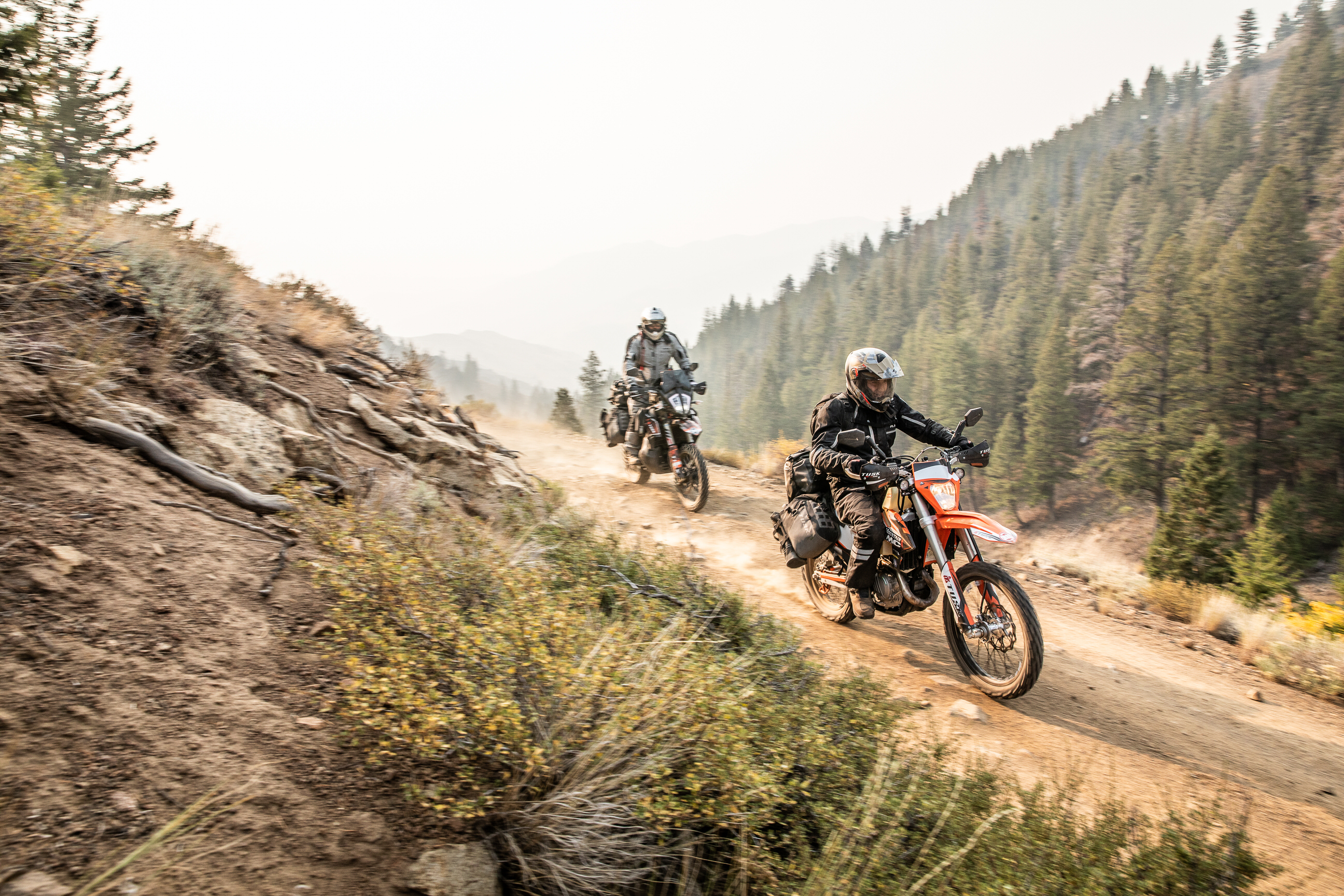
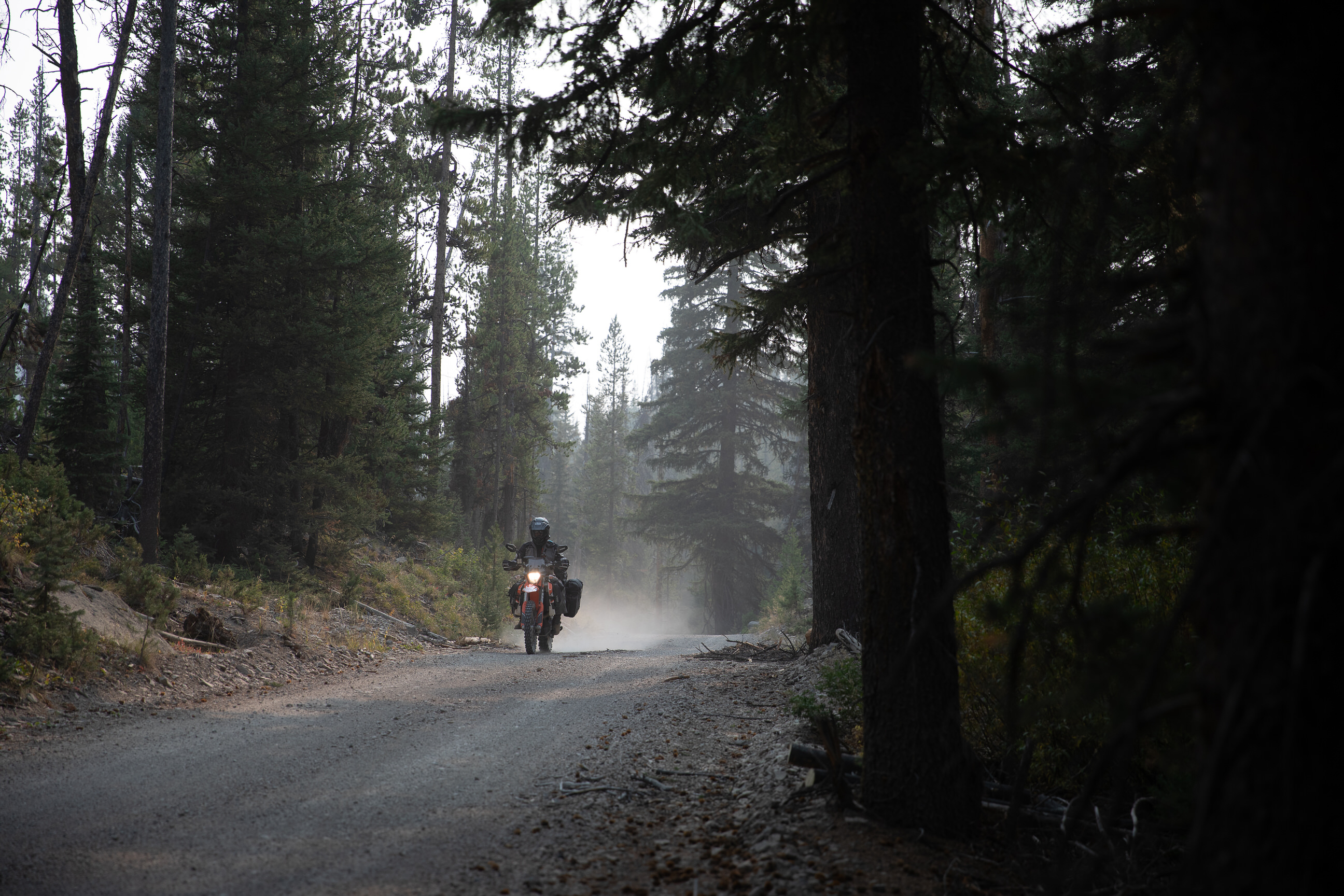
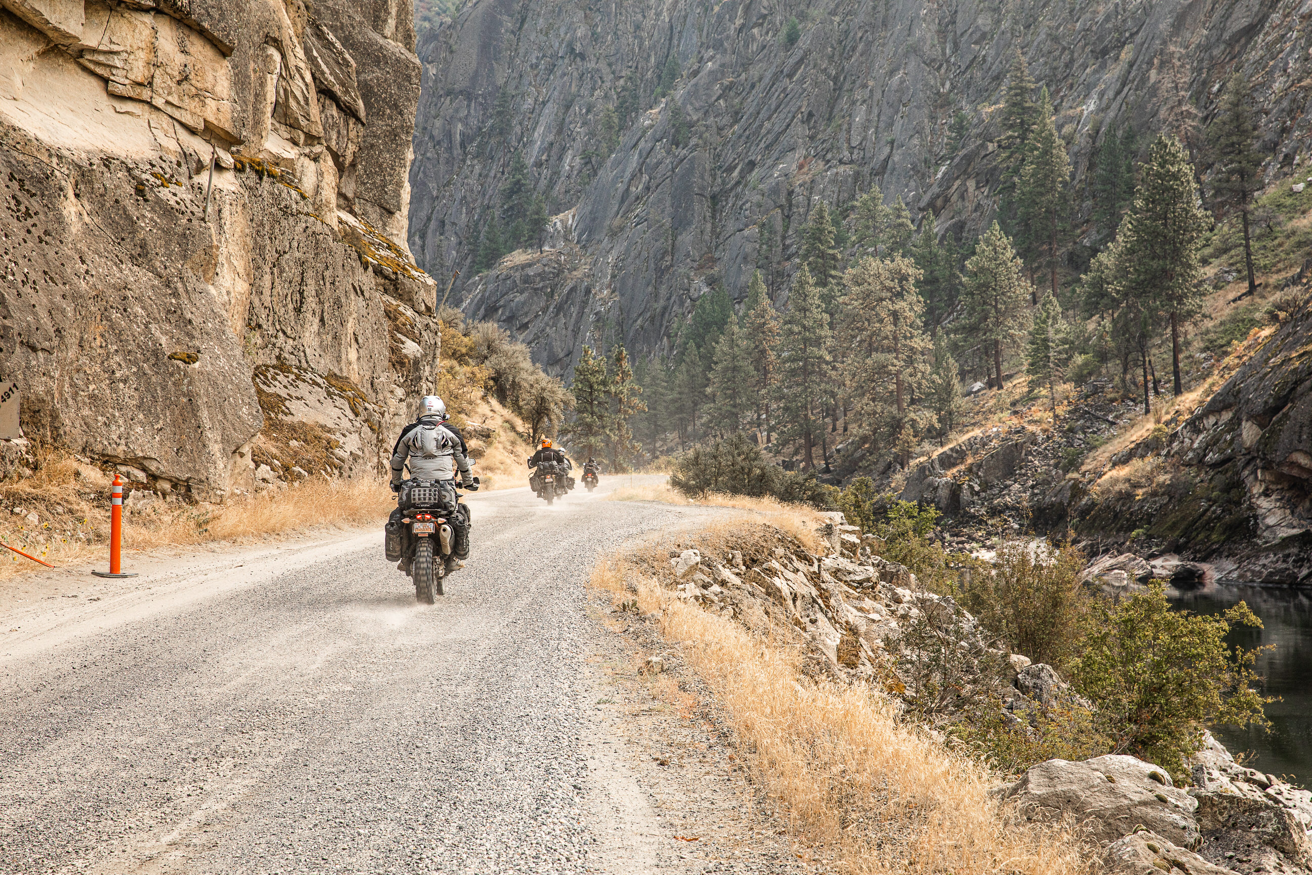
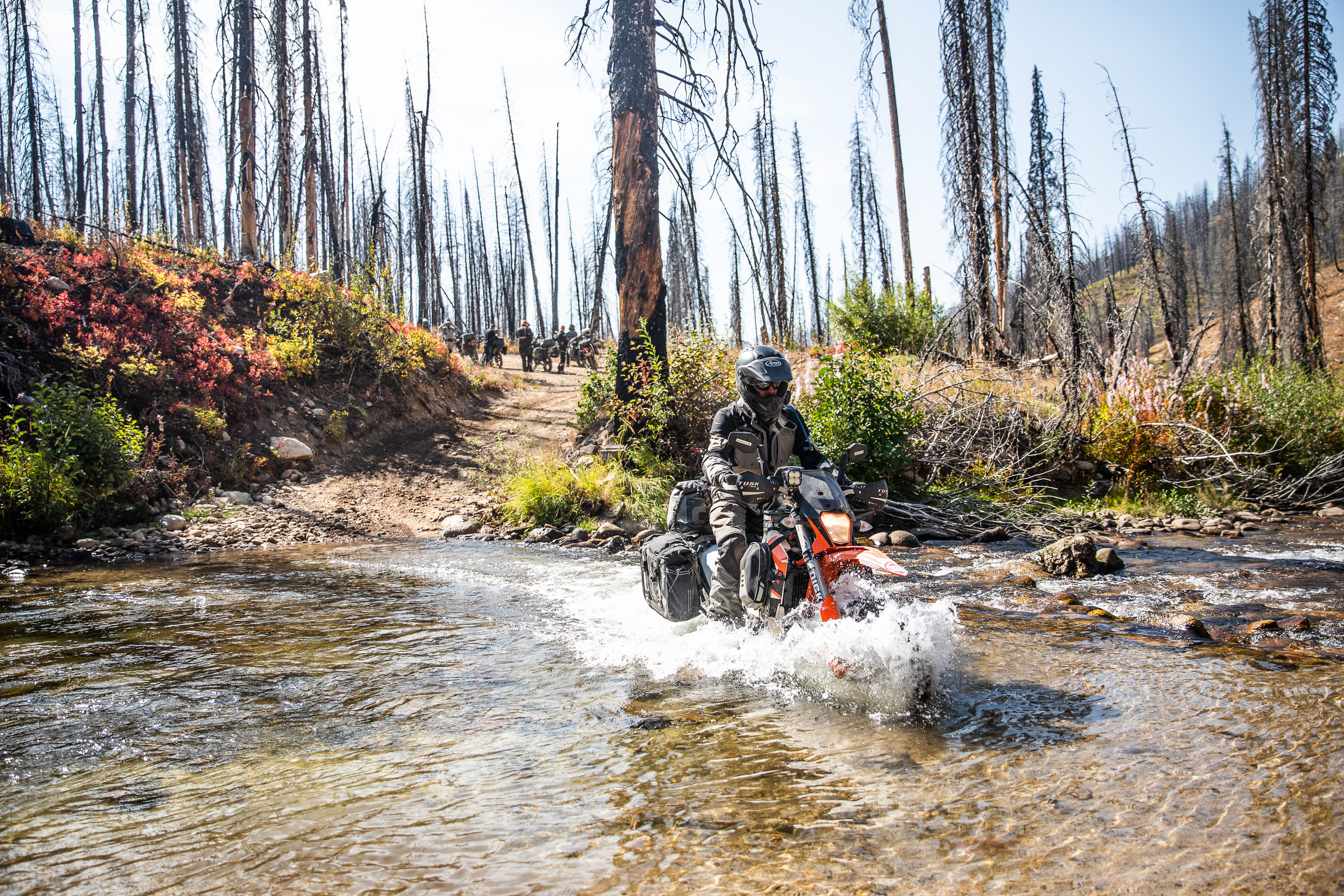
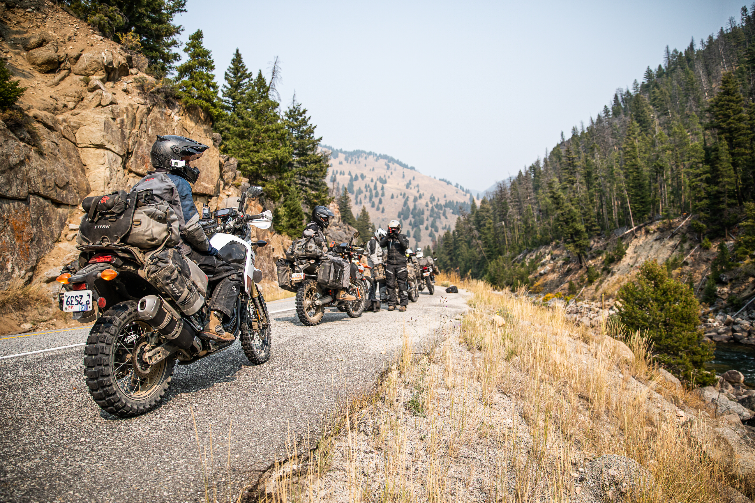
The difficulty of this ride ranges anywhere from paved roads to technical, rocky, steep terrain. If possible, the most difficult sections of these rides will have a bypass (which is indicated in our maps if they are available), but the availability of the less difficult bypass is not guaranteed, and on occasion, the only way forward may be through a difficult section. While we try to highlight the difficult sections in the videos, specific trail conditions vary from year to year and storm to storm. We recommend that anyone attempting these rides get the most up-to-date road and trail conditions from local state, county, or land use agencies where available. If you notice any trail conditions that are different from what is shown in these videos, please send those trail condition updates to [email protected].
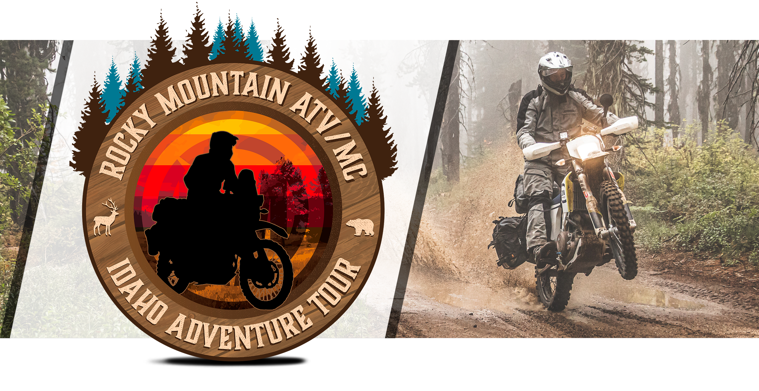
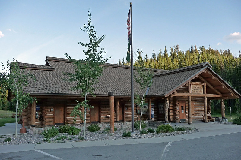
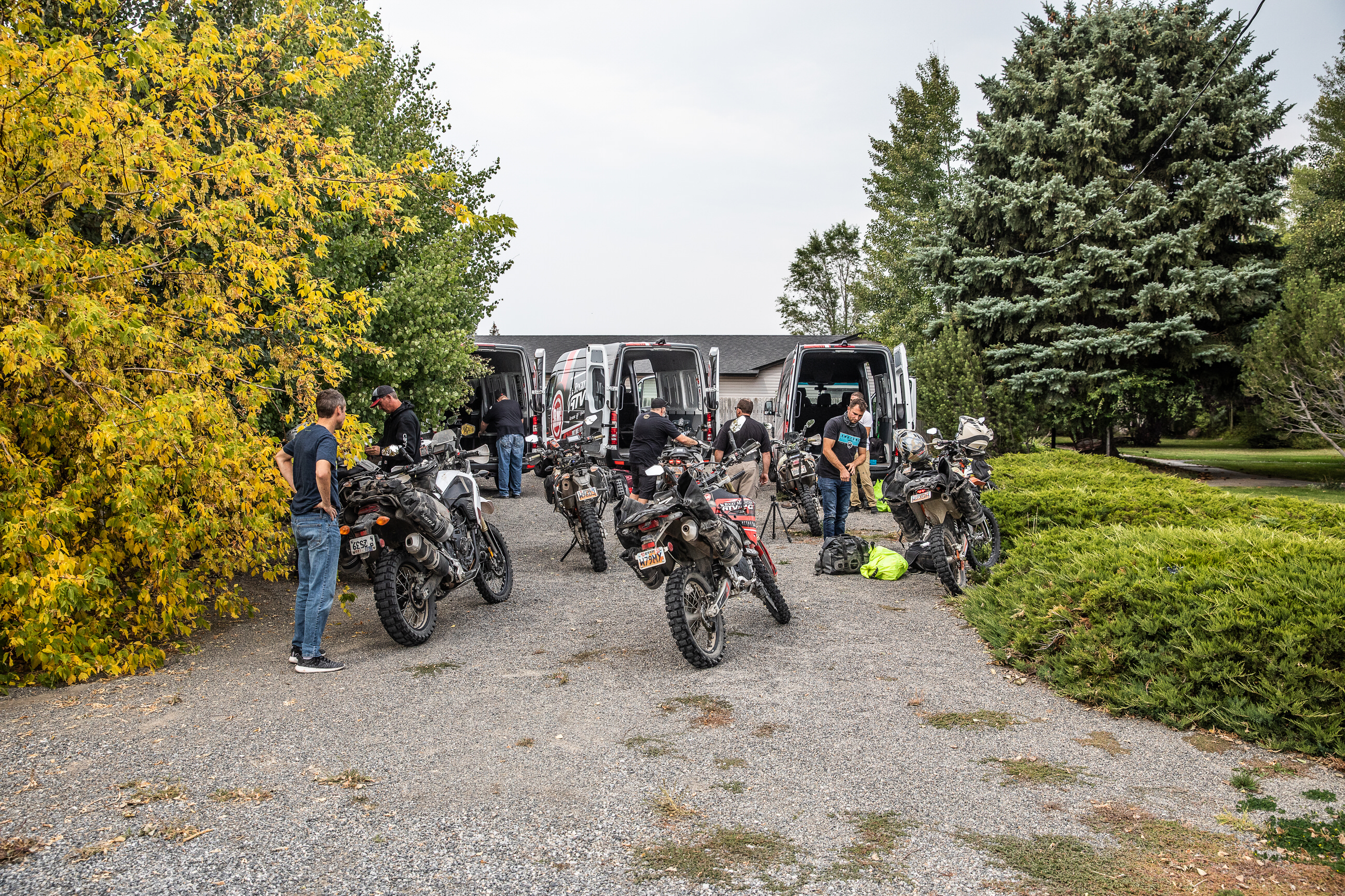
Idaho Adventure Motorcycle Tour
Admin // February 14, 2021
View Videos
Have questions about this ride? Shoot us an email:
About
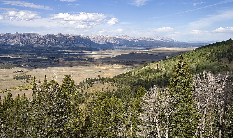
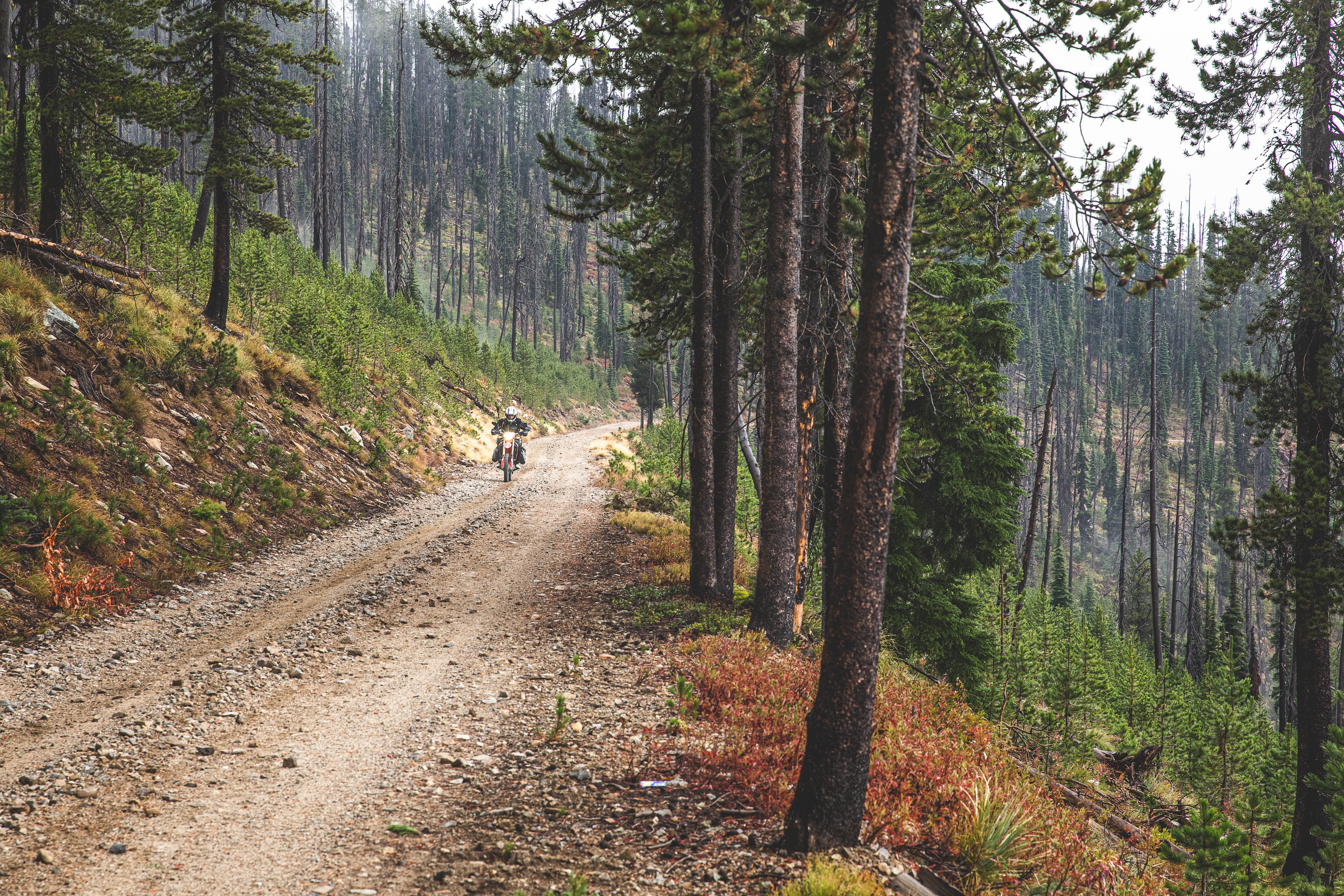
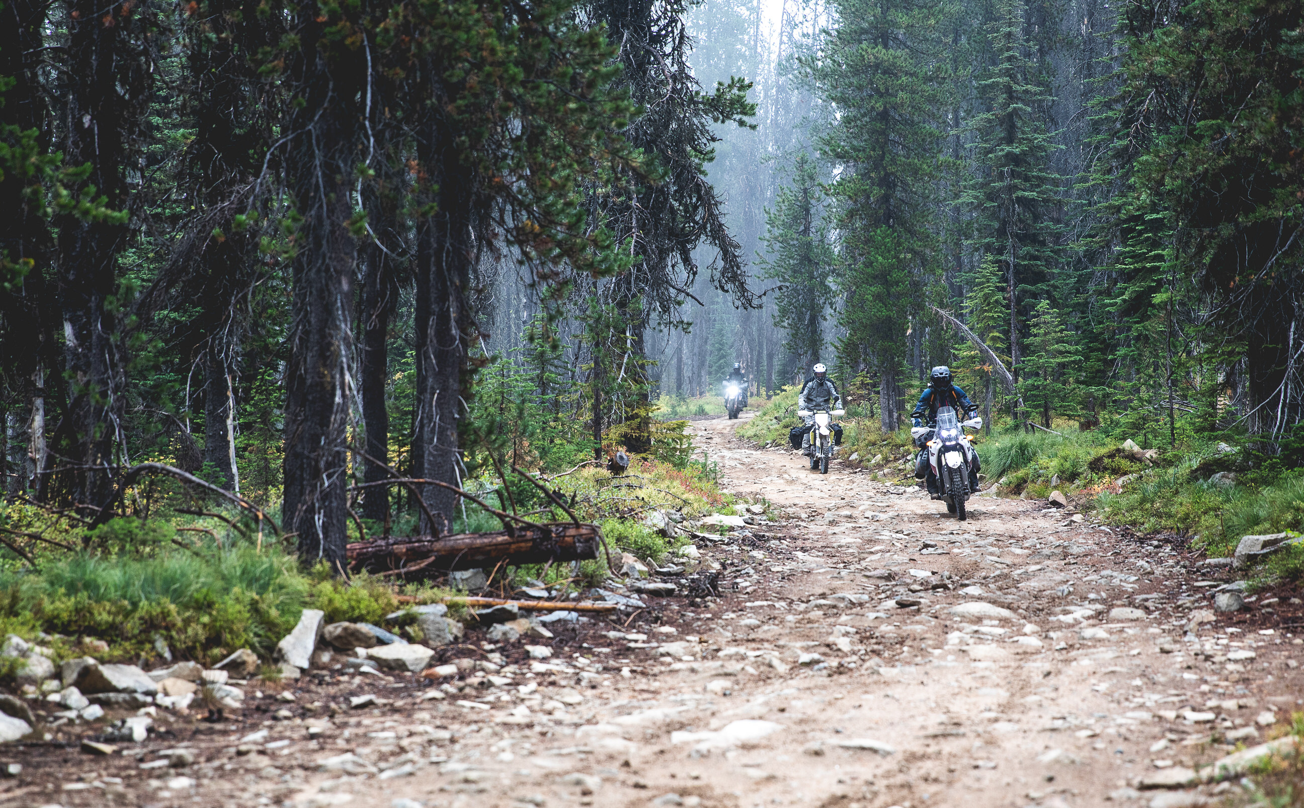
Beside towering pine trees, along winding rivers, and through wide open spaces, the Rocky Mountain Idaho Adventure Motorcycle Tour showcases the unexpected and varied beauty of an all-too-often overlooked state.
What started as a spur-of-the-moment idea has turned into one of our favorite routes of all time. Starting in Southeastern Idaho, the route traverses National Forests, climbs over mountain passes, and passes through miles and miles of wilderness. Ghost towns, old-fashioned gas stations, and age-old stops along the way offer a look into places time has seemingly forgotten.
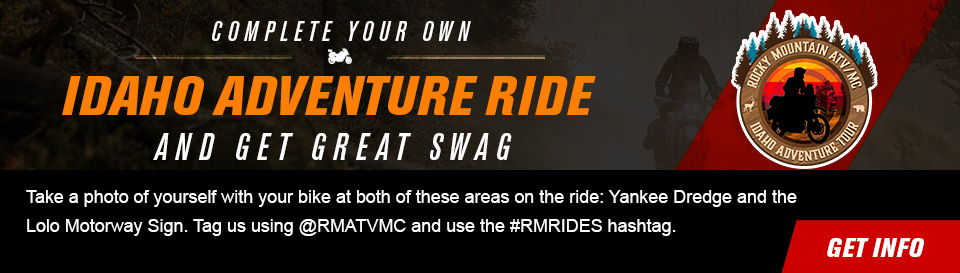
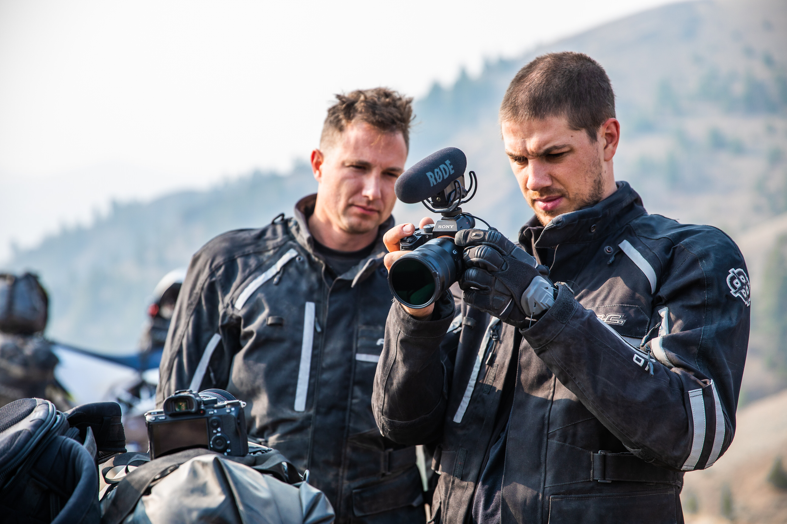
The entire ride has been documented in a video series and companion blog post to help you more easily plan your own adventure. Use the GPS files above to follow our same route, or check out the drop-down boxes for each day to read about other activities you could plan along the way. With this article as a resource, you can begin to prepare for your next adventure.
Preparation
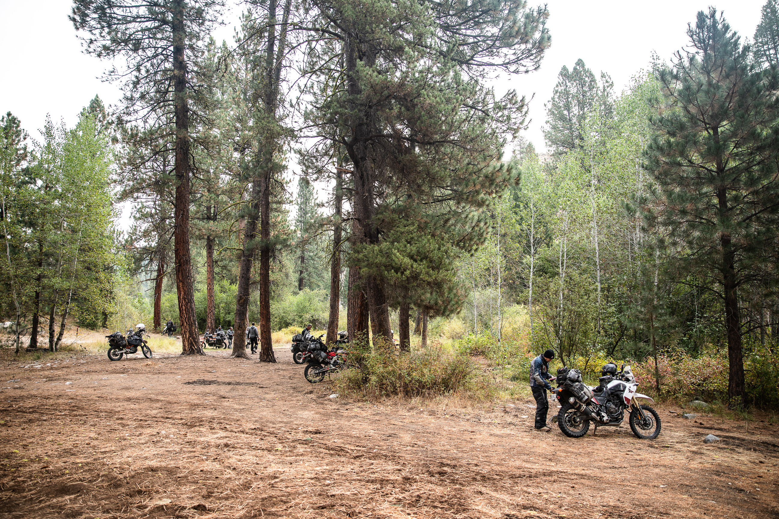
This ride was a little different than our other ones in the sense that we knew we just wanted to get out and ride. So, inspired by Backcountry Discovery Routes and a friend with experience riding in Idaho, we made a loose plan for the ride. Where each gas stop, campsite, and hotel has typically been planned out, we decided to pack up the bikes with just a rough timeline and few key stops along the way. You can do the trip like us, or you can take a look at the route map above and days below to see where each day ended for us.
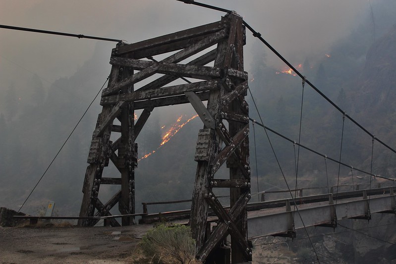
For this ride specifically, there are a few things to keep in mind. First is fire season. Over the summer months, rural Idaho is at a huge risk for fires. During our ride, we rode beside a few fires and even got turned around because of one. Check the Idaho Fire Map and fire restrictions before heading out so that you know what to expect. June-September is the best time to complete this ride, so chances are high that you’ll have to plan around at least one active fire.
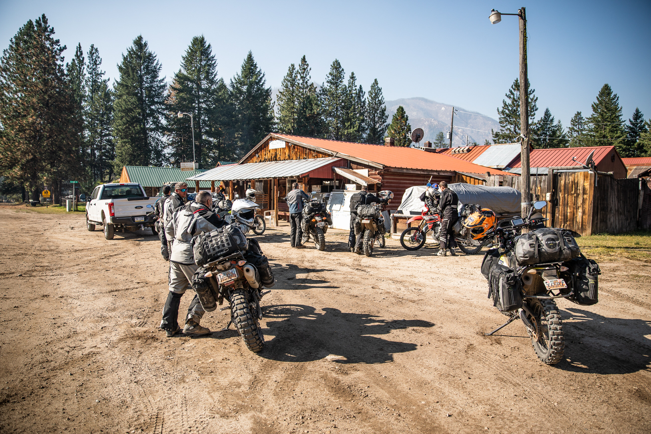
The second thing to keep in mind is gas. It’s an important consideration for any ride, but this ride poses a unique challenge in that several gas stations along the way feature old-fashioned, gravity-fed gas pumps. Rather than gas being measured as it fills your tank, its measured by the amount removed from the cylinder. It’s certainly unique, but something you’ll have to get used to nonetheless on your own tour through Idaho. So, learning how to pump that type of gas on your own is one thing, but arriving at these gas stations while they’re actually open is another. We were fortunate enough that every gas station we came to was easily accessible and open (or opened for us, in one case), but it’s always worth carrying a little extra fuel in case the station you stop at is unexpectedly closed; in these small towns, it can happen. If you have a bike within the 200 miles per tank range, however, you should be fairly safe.
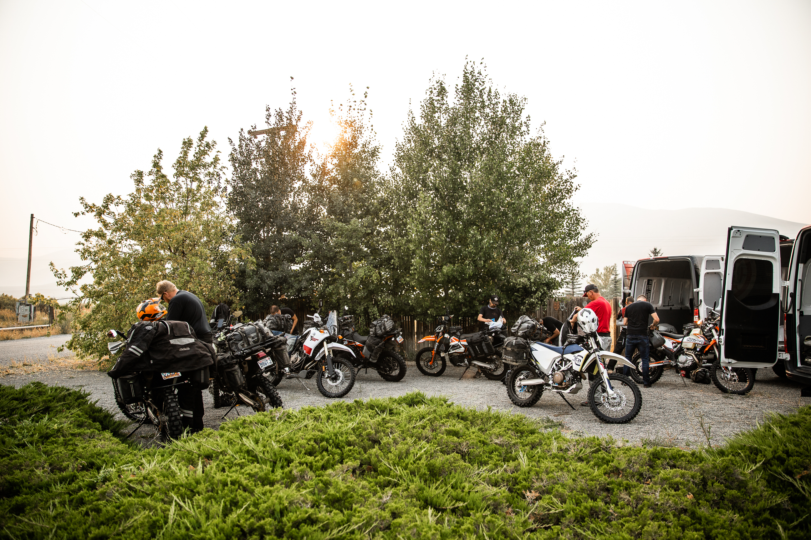
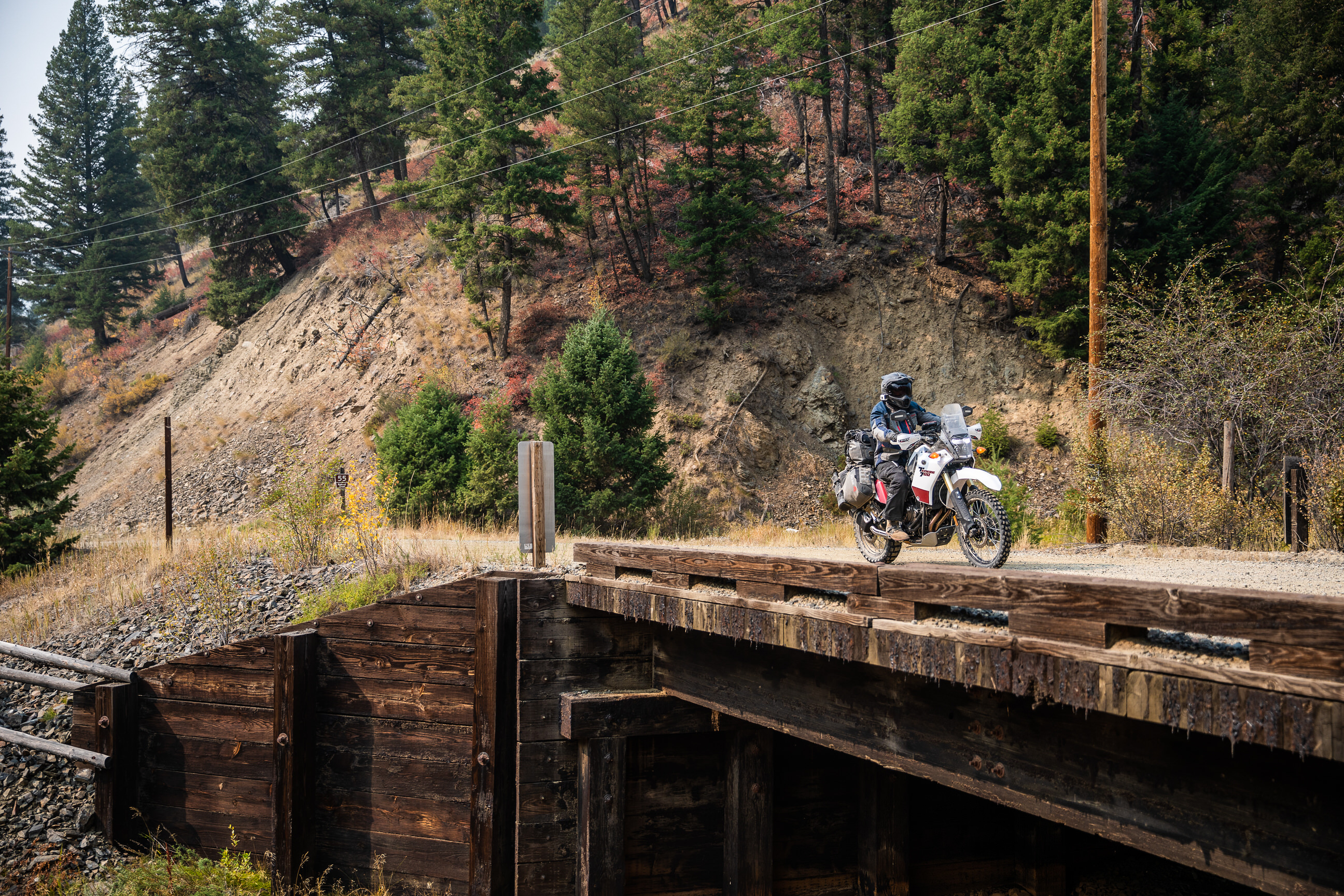
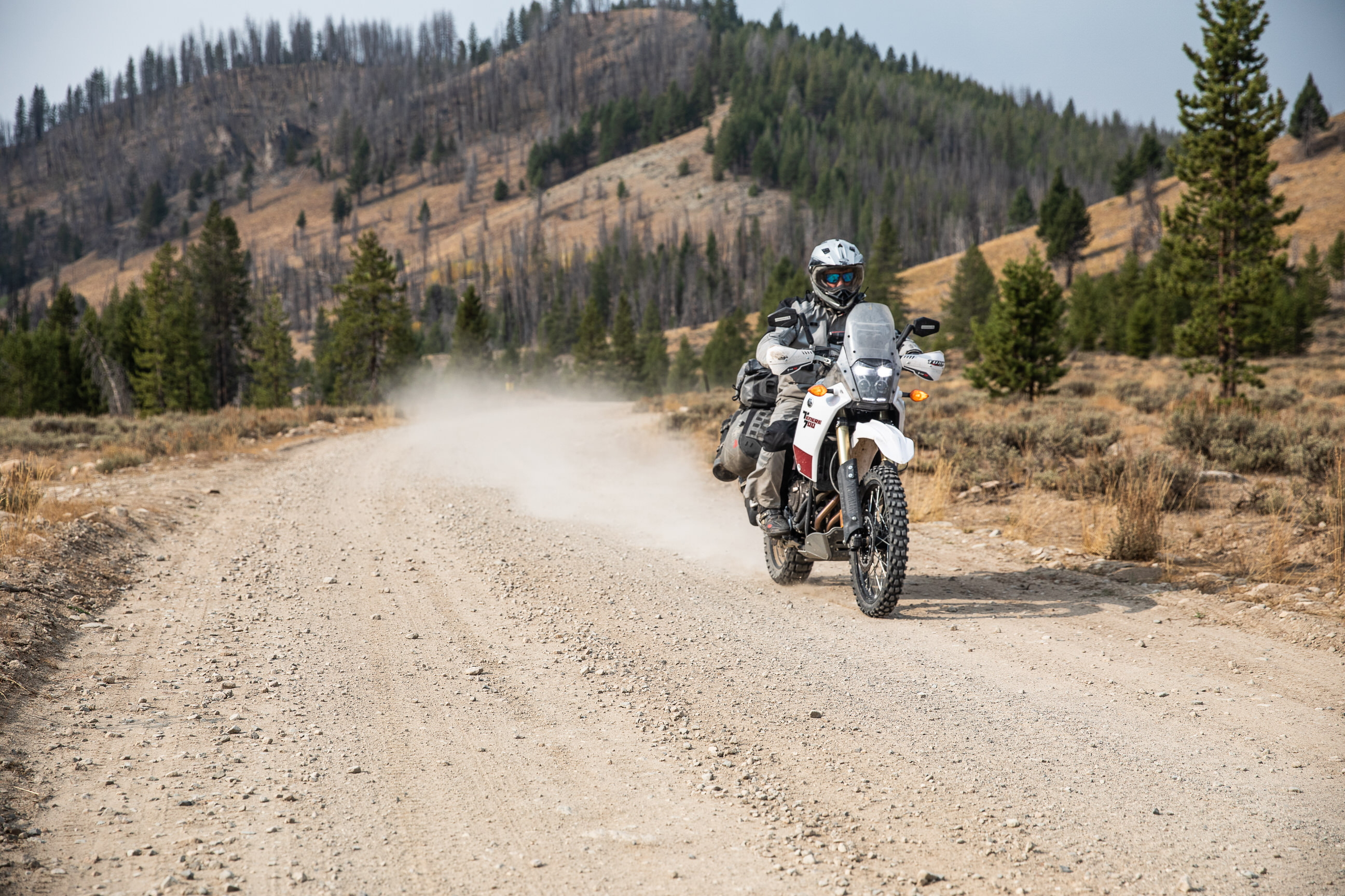
When it comes to gear and bike prep for this ride, you need to get you and your bike ready for approximately eight days of riding. There isn’t anything too gnarly, so most big and little bikes alike will handle just fine so long as they have good dirt tires and skid plates. Larger gas tanks, or even a way to carry extra fuel like previously mentioned, would be worthwhile additions to consider as well – you never know what closed road or long detour can complicate your trip.
Another accessory you need to have is a GPS. Through logging roads and the miles and miles of wilderness, a good GPS will quickly become your best companion. Whether you’re getting a GPS for navigation, communication, or both, it’s something you’ll use every day and not want to ride without.
As for your gear and other bike prep, check out the helpful resources below. For any ride, you need to make sure you have the right gear, supplies, tools, and a plan in case of an emergency, and the links below can help you figure those things out.
In preparation for any adventure ride, it is critical you take time to carefully plan. Not only do you need to plan routes, food and time, but you need to make sure that your bike is ready and that you have the right tools, riding gear, camping gear and emergency equipment.
This 8-day ride through Idaho showcases some of the most incredible landscapes in the country and terrain people never knew the state was hiding. Whether you follow our route or use it as inspiration for your own, a ride through Idaho will give you stories to share for a lifetime.
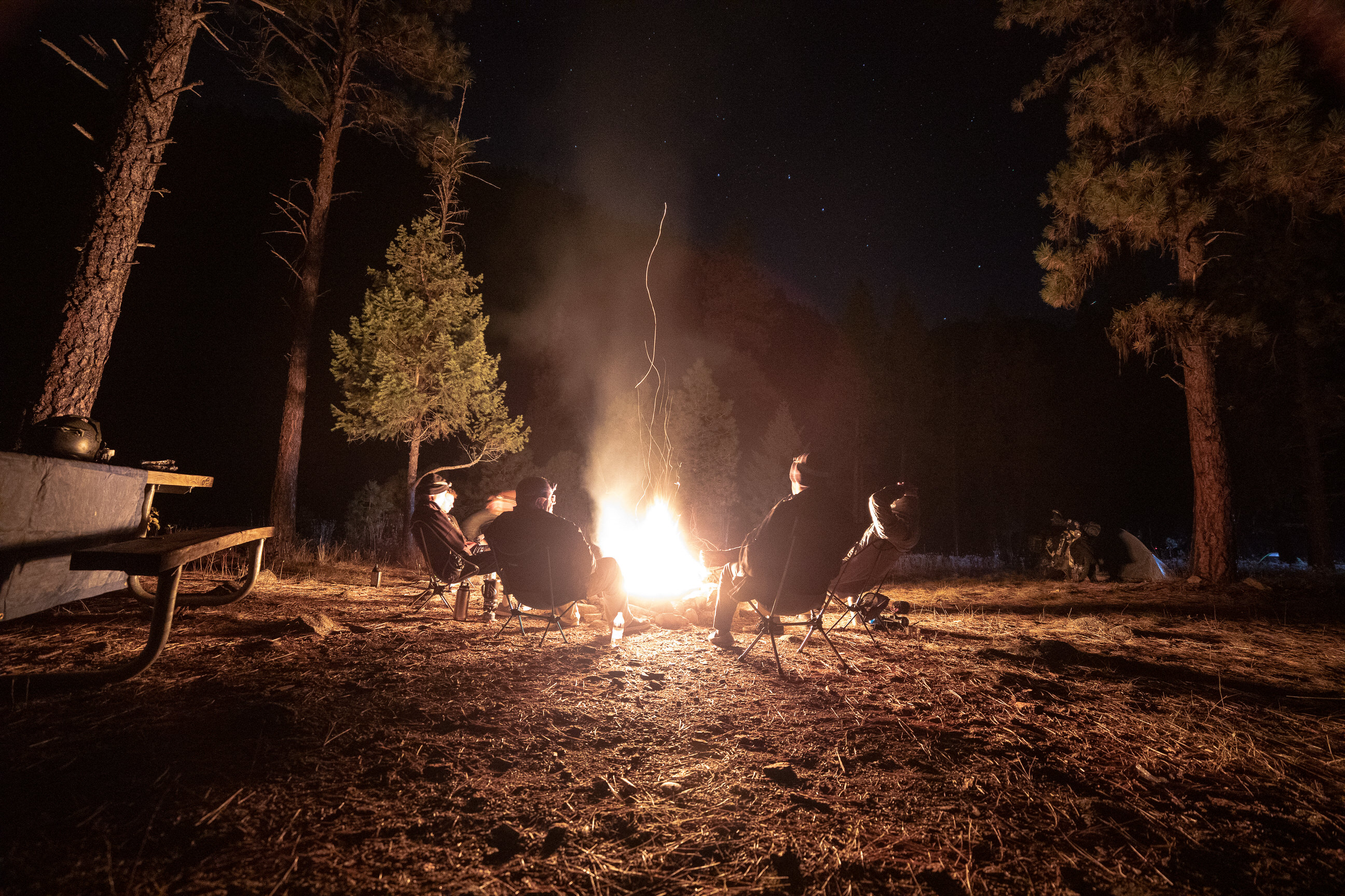
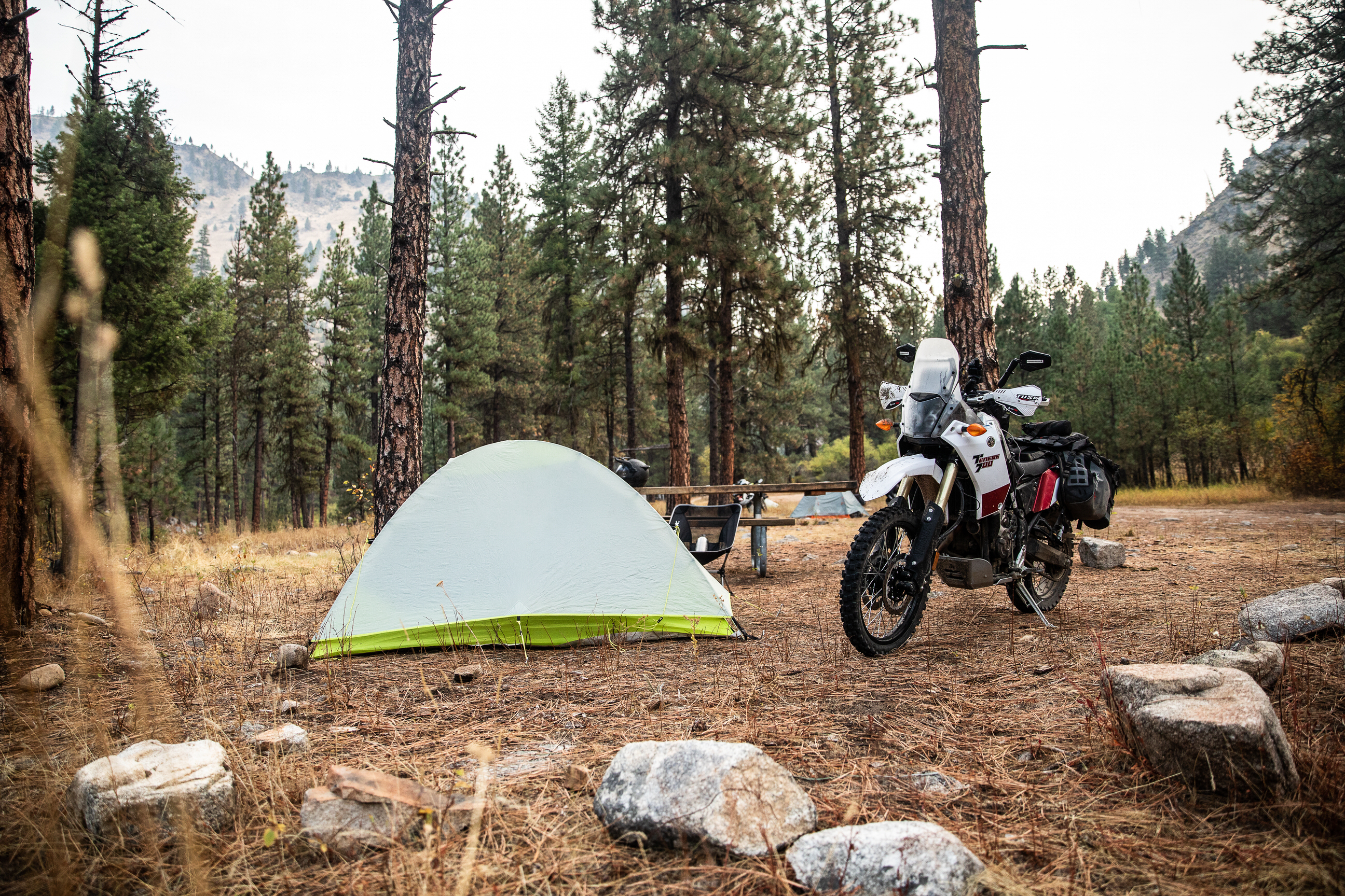
The first day of this ride doesn’t actually include much riding at all. After planning and packing, make the drive to Arco, Idaho. For us, that was a four-and-a-half-hour trip from Payson, Utah. There are a few interesting sights to see in Arco before fueling up and heading towards Stanley. It’s a few short minutes of riding to the Burnt Hollow campground in the Challis National Forest, and, depending on your timing, you very well may be setting up camp in the dark like us. Either way, the first day of this ride is just a preview of the spectacular views and sweeping scenery yet to come.
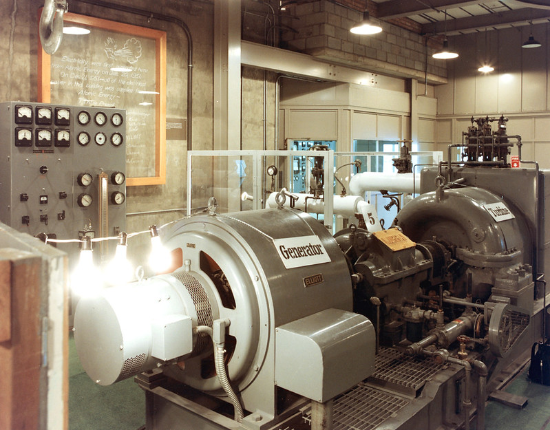
Experimental Breeder Reactor-1
A tiny town in Idaho with a population of under 1,000 people isn’t the most obvious place for the world’s first nuclear reactor, but Experimental Breeder Reactor-1 is now an integral part of Arco’s history. Built in 1951, the small reactor was used to power just four lightbulbs. Scientists wanted to know if nuclear energy was useable and, by the light of those bulbs, it became clear that it was. Shortly after the lightbulb experiment’s success, the Arco reactor was used to power a whole building. News of the energy spread, and reactors began cropping up all over the world. The Experimental Breeder Reactor-I was decommissioned in 1964 to be turned into a museum. It’s a rare look into the influential history of nuclear power and one of the only museums of its kind.
EBR-1 Internal by Idaho National Laboratory (CC BY 2.0)
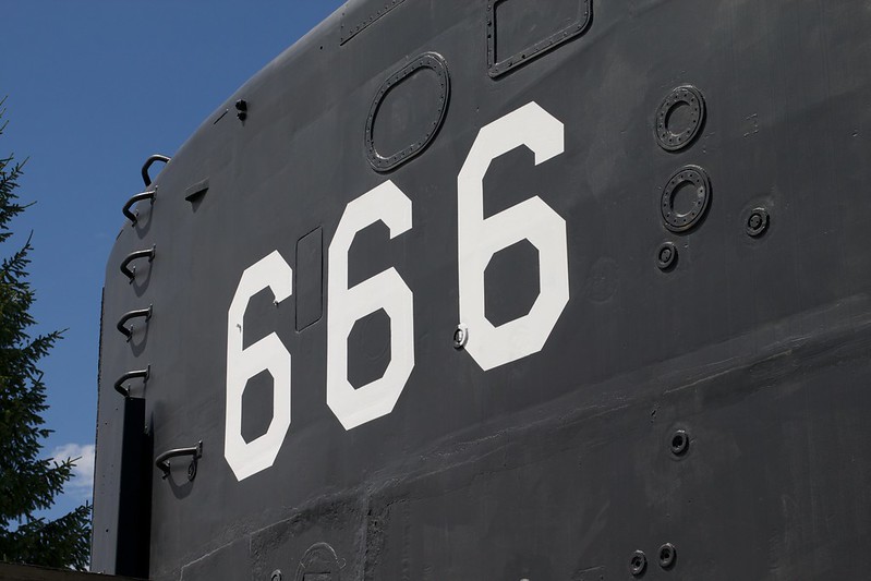
The Devil Boat
Driving through Arco, a black structure emboldened with a 666 may make your head turn. If it does (and even if it doesn’t), it’s worth a stop. The 666 is the hull number for the USS Hawkbill (SSN-666), a Sturgeon-class attack submarine. The boat was built in 1964 and decommissioned in 2000. Over its 29 years of service, the submarine was deployed 16 times and become best known for its expeditions in the Arctic Ocean; the Hawkbill’s construction allowed it to break through 3’ of solid ice when it surfaced. Following the submarine’s decommission, its preserved sail was sent to Arco to memorialize the relationship between the Navy and the nuclear fleet.
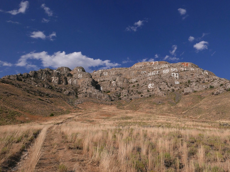
Arco is a town with a storied history, but one of the coolest memorials is one to its students. Number Hill, or Graduation Hill, is a large hillside that is covered with years painted by the high school’s graduating class. Each year, the seniors climb the hill and paint their graduation year by their predecessors’. As far back as 1925 can be seen, along with the most recent years of graduation.
The Lost Rivers Museum is the result of a large volunteer effort, run on donations and volunteer hours. There’s no charge to visit the museum that showcases artifacts from pioneers, prospectors, and early settlers in the valley. Mining tools, ranching equipment, railroad memorabilia, historical photographs, and more have made the past that much more accessible. And, just as interesting as the artifacts in the museum, the museum itself is housed in a 100-year-old church.
Mackey/Mackay Mine Tour
A self-guided tour of an open-pit mine at the top of a mountain, the Mackey/Mackay Mine Tour is a quick thrill and great look into Idaho’s mining history. The site was active for over 100 years before it was closed in the 1980s, producing an estimated 42,000 ounces of gold, 2 million ounces of silver, 62 million pounds of copper, 15 million pounds of lead, and 5 million pounds of zinc. Once depleted, the mines were all but abandoned, leaving the old buildings and actual mines up for exploration. If you find yourself with any free time, this is definitely a spot to check out.
GPS File Name: Camp 1 to Stanley
GPS File Name: Stanley to Pinyon/Loon to Yankee Fork
GPS File Name: Yankee Fork Bypass
Day 2 is not a complicated one, but the opening views and changing terrain certainly make it an exciting day. The first part of the day will be spent riding towards Stanley, Idaho. It’s more of a desert landscape, though the route does go up and over some incredible vistas and partially along the East Salmon River.
After about 100 miles of total riding, you’ll reach a great spot in Stanley to grab some fuel and some lunch. About 18 miles past Stanley, you’ll get off the slab and onto dirt. We took a break just a little bit after to clean our shields and go over the route one more time.
Once you hit dirt, you’ll be on the Loon Creek Loop. We had to turn around after just part of the loop on account of a forest fire, which was disappointing. The alternate route and portion of the Salmon River that the trail rides next to is absolutely beautiful, though, which almost made up for missing Loon Creek Loop. The road will eventually take you to the old Yankee Dredge, which you can read more about below for this day of the ride. Just an hour past the dredge is Challis, though we decided to end our day early at a developed campground that allowed us to have a fire.
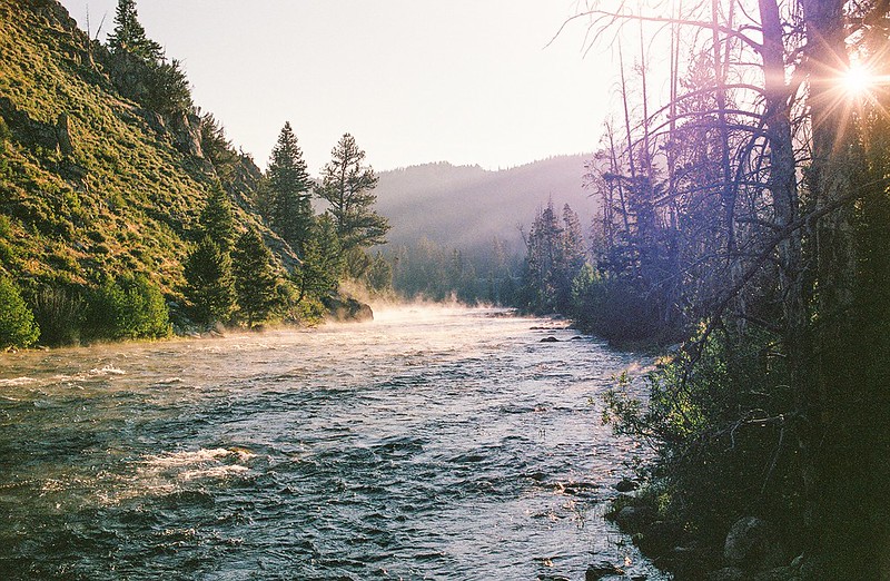
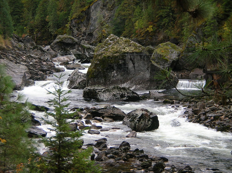
Salmon River
The Salmon River, or The River of No Return as it’s nicknamed, is a 425-mile river that snakes its way through the No Return Wilderness. It’s an ominous name for a breathtaking feature – dropping more than 7,000’ from its headwaters at Galena Summit, the river is host to incredible scenery and teeming wildlife. The river used to only be traversable one-way due to extreme rapids, but electric boats have now made it possible to access the river in any direction. As you ride along it, you’ll likely spot boaters, fishermen, and even a few gold dredges and mines.
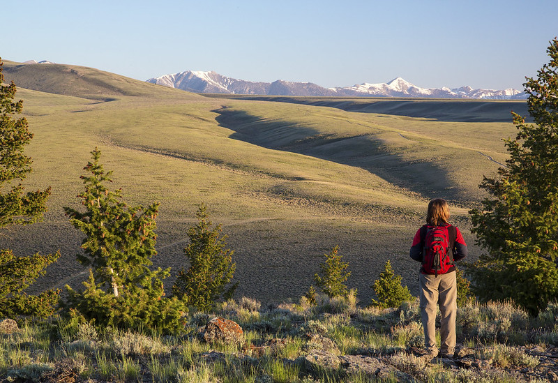
Adventure riding has provided us with some of the best experiences and memories we have, but that doesn’t mean it hasn’t been hard to push forward sometimes. Like most other good things in life, riding takes discipline, hard work, and, more specifically, the occasional mountain viewpoint to put things back into perspective. The Antelope Pass Viewpoint certainly does that. At 9,000’ above sea level, the pass offers panoramic views from the top with high meadows, livestock, and wild animals like deer to marvel at along the way.
Pinyon Peak
One of the highest roads in Idaho sits at nearly 10,000’ elevation. Pinyon Peak is a towering ridge compared to the mountains around it, making it the perfect place for an actively-manned, albeit historic fire lookout. It’s a long and rocky climb to the top, though, with several washed-out areas to the summit.
vista; Sawtooth Mountains, Idaho by Global Jet (CC BY-SA 2.0)
Loon Creek Road
If you’re riding anything like our route, you have no choice but to travel on Loon Creek Road. That said, it’s a road worth appreciating. Off the beaten path, Loon Creek area is surrounded by rivers, creeks, lakes, wilderness, and dozens of trailheads. It’s the path to anywhere and nowhere, proving that the adventure is in the trip, not the destination.
Yankee Dredge
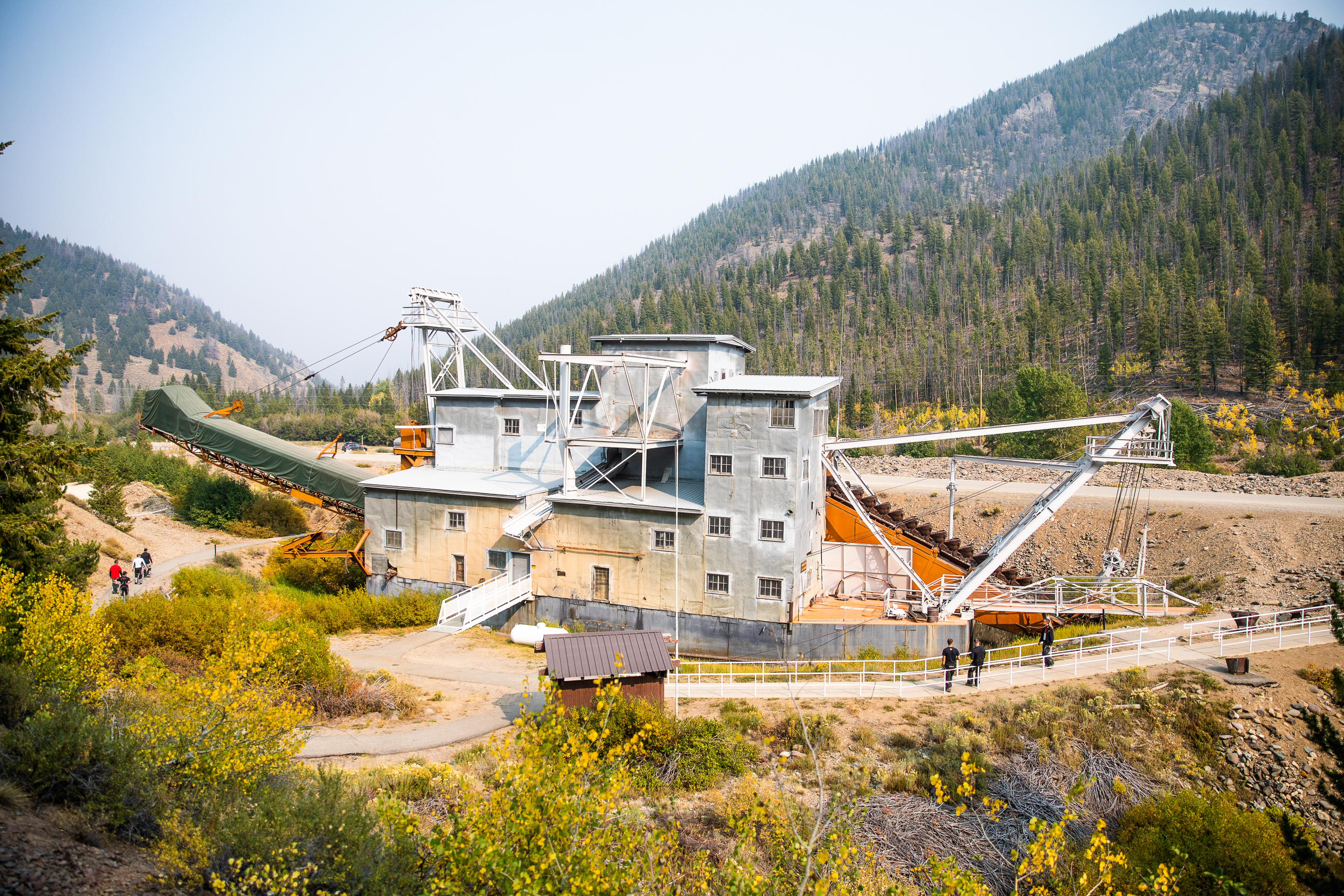
Along the route, a towering, sprawling structure beside the Salmon River is bound to catch your eye. Miles of soil disturbance before the building, however, are what will really get you curious. Chances are you are riding past the Yankee Dredge, a placer mining machine constructed in the early 1940s. Idaho was a hub for miners and prospectors during the Gold Rush, and the land by the Yankee Fork tributary was rumored to have $11 million in un-mined gold. So, the dredge was built to pull gold from sand, gravel, and dirt using water and mechanics. Buckets – 71, to be exact – of material were pulled, and that material was sorted and sifted through water. Oversized material got dumped behind the dredge (creating the tell-tale path of silt for miles), while the smaller, finer material got sorted again. The millions in gold were never found, and the dredge was only active for approximately six years before it was abandoned. Since it was officially shuttered in 1952, the mining machine was donated to Idaho to serve as a tourist site and memorial to the area’s rich mining history.
Custer, Idaho
Just past the Yankee Dredge is Custer Idaho, a town formed in 1879 by hopeful prospectors. Custer was just a one-street town, but it was a center of mining activity and home to over 600 people in 1896. Resources dried up and miners moved on, however, making Custer a ghost town by 1910. The area sat abandoned until 1981 when it joined the National Register of Historic Places. Since joining the register, the town has been restored to its 19th-century glory. Tourists can pass through and get a unique look into what life was like for early miners.
National Wilderness Month_Sawtooth Valley by GPA Photo Archive (CC BY-SA 2.0)
GPS File Name: Yankee Fork to North Fork
GPS File Name: Blue Nose Lookout
GPS File Name: North Fork Magruder to Elk City
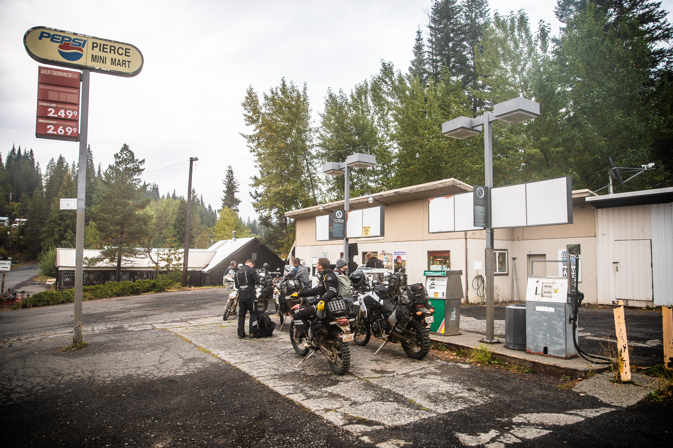
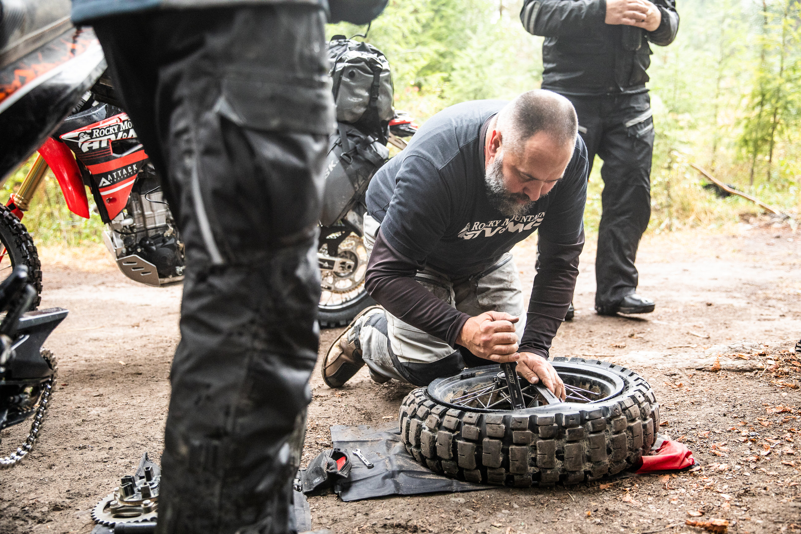
If you stop at the same campground we did, you’ll be approximately 200 miles into the trip. As we explained, this ride is a lot more laid back than some of our others, so take some time waking up and getting to Challis to fuel up and get some breakfast. Your next stop will be in North Fork an additional 100 miles away, but there’s plenty of beautiful road to enjoy along the way. Past Panther Creek, the route drops down to the Salmon River. A scenic bridge and gas station with vintage pumps wind along with the river until you get to North Fork. It’s a great place to fuel up, get food, and check on your bike. We’re speaking from experience, here, as Ray found a nail in the knobbies of his tire at this point.
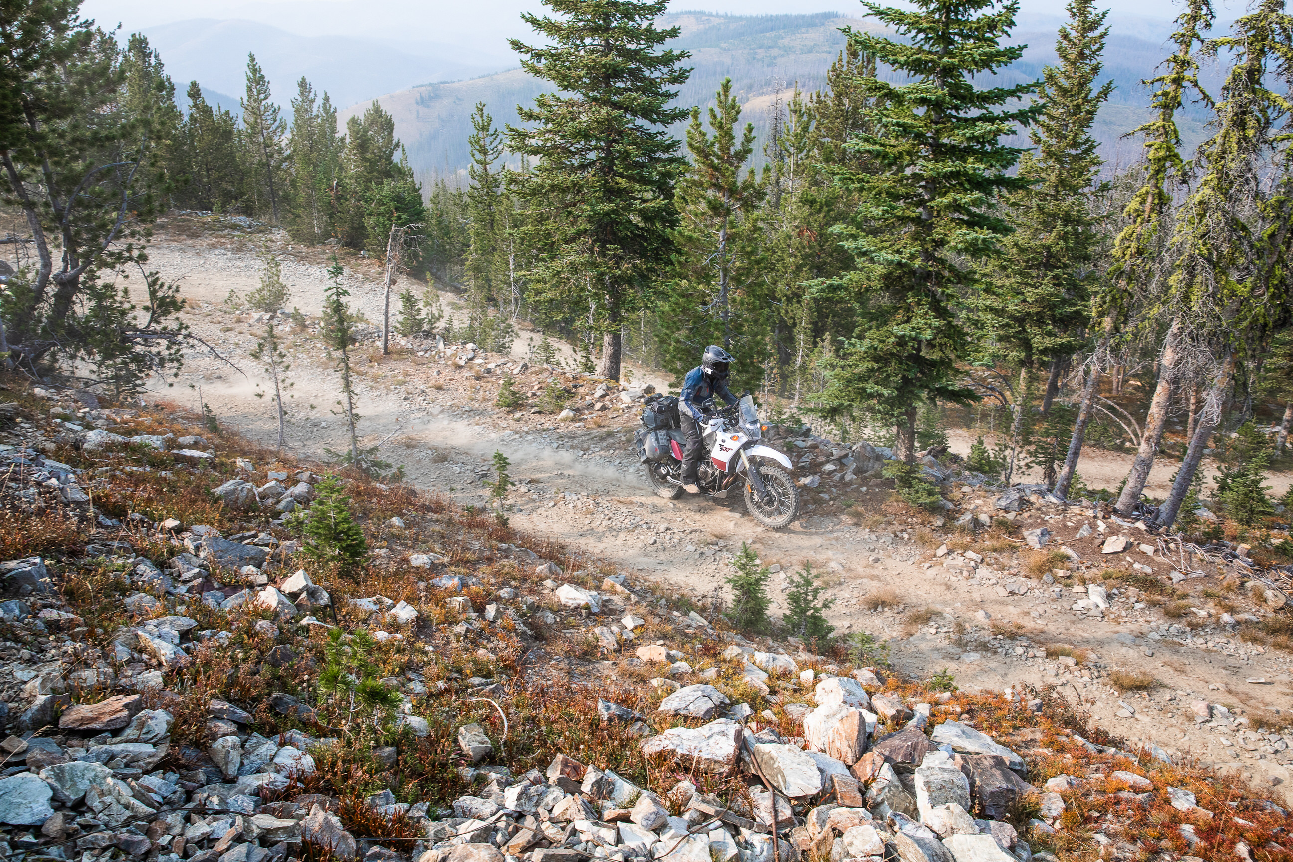
After lunch, get back on the pavement and ride until it ends and you end up on a dirt road, heading north, and you’ll be well on your way to a good camping spot. The path up to Blue Nose Lookout is arguably the only technical section of the entire route and it is optional, though it is rather fun and the views certainly don’t disappoint.
From the Lookout, you’ll pass by a pristine lake and ride on some logging roads the last 40 miles to camp. These roads often resemble a maze more than anything else, so it’s helpful to have a GPS device here to make sure you don’t get too turned around. We might’ve lost our way a few times, but that’s just part of the adventure, right? Either way, the Fales Flat campground is waiting just off the side of the road and is the perfect place to rest after the third day of riding.
Land of Yankee Fork State Park
Land of Yankee Fork State Park is another state park stop, but one that is focused on historical sites rather than natural landscapes. Including the Yankee Dredge, several ghost towns, and other assorted pieces of history, the Land of Yankee Fork is a comprehensive and interesting look into the past. There is an operational visitor center and, if you time your trip right, you can see a live shooting reenactment or listen to an accurate oral history of the area from locals.
Duncan's Outpost
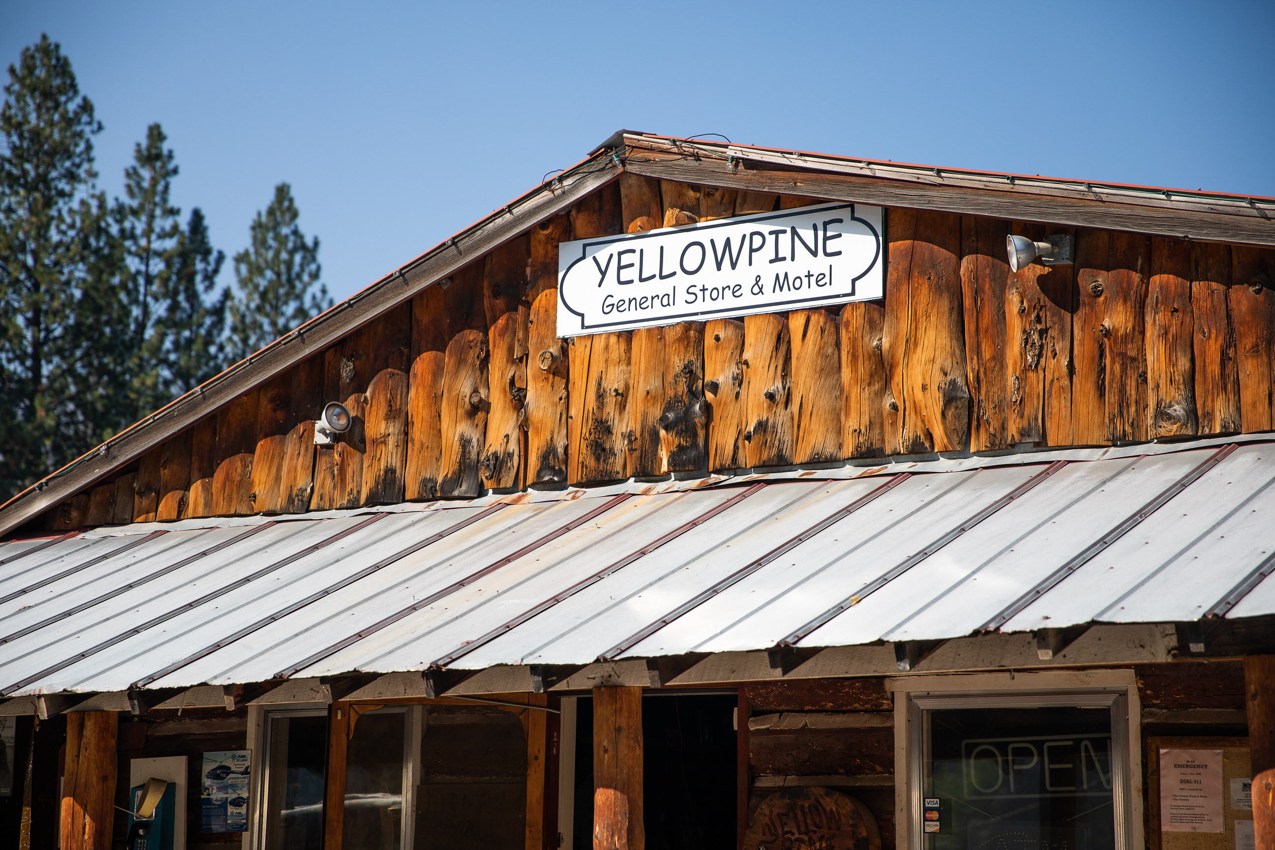
Some of the key stops on this adventure trip are shops like Duncan’s Outpost along the river. Food, drink, snacks, and good company are all reasons to stop. The locals are knowledgeable, the area is beautiful, and it’s likely you’ll want to stop in between meals to stock up for your ride.
Schoup Store
Another must-stop along the river is the Schoup Store, a historical treasure in its area. The store is the center of a historic town that serves as a stop for a lot of recreational activities – steelhead runs, hunting, rafting, and ADV riding. Snacks, drinks, and food are available, along with good hospitality and cool old-fashioned gas pumps. Just make sure that it’s open before you try and stop, it was closed when we rode past it.
Blue Nose Lookout
In a state with such active fire seasons, it makes sense that there are so many fire lookouts in Idaho. Many of them have since been abandoned on account of more advanced ways to spot fires, as is the case with the Blue Nose Lookout. That said, the tower served its purpose for several years before being left behind. In 1918, 20 field men working in the Salmon Forest relied on the tower to spot fires. By the early 1920s, a full-time employee and their family lived below the station to man it at all hours. By the 1950s, however, the tower was abandoned. Today, you can still ride up to it.
Painted Rocks State Park
“Painted Rocks” is a fitting name for this Montana state park. Tall black and gray rock walls surround a reservoir, but green, yellow, and orange lichen give the rocks a painted look. The colored walls stand starkly against the water and surrounding landscape, making it a site worth seeing. There’s a lot to do in the 23-acre park, but if you’re short on time, a quick break at their picnic tables and toilets will still provide plenty of views. If you’re lucky, you may see some of the wildlife the park offers – elk, mule deer, black bears, moose, sheep, and falcons just to name a few.
GPS File Name: Elk City to Missoula
GPS File Name: Alt Lochsha to Lolo
Day 4 may have you waking up a bit worried about bears. We certainly awoke with some degree of paranoia, but we managed to make it out of the campsite completely unscathed. That being said, it’s always wise to brush up on local wildlife before embarking on a multi-day adventure ride – it will give you some know-how and certainly the peace of mind that comes from having a plan.
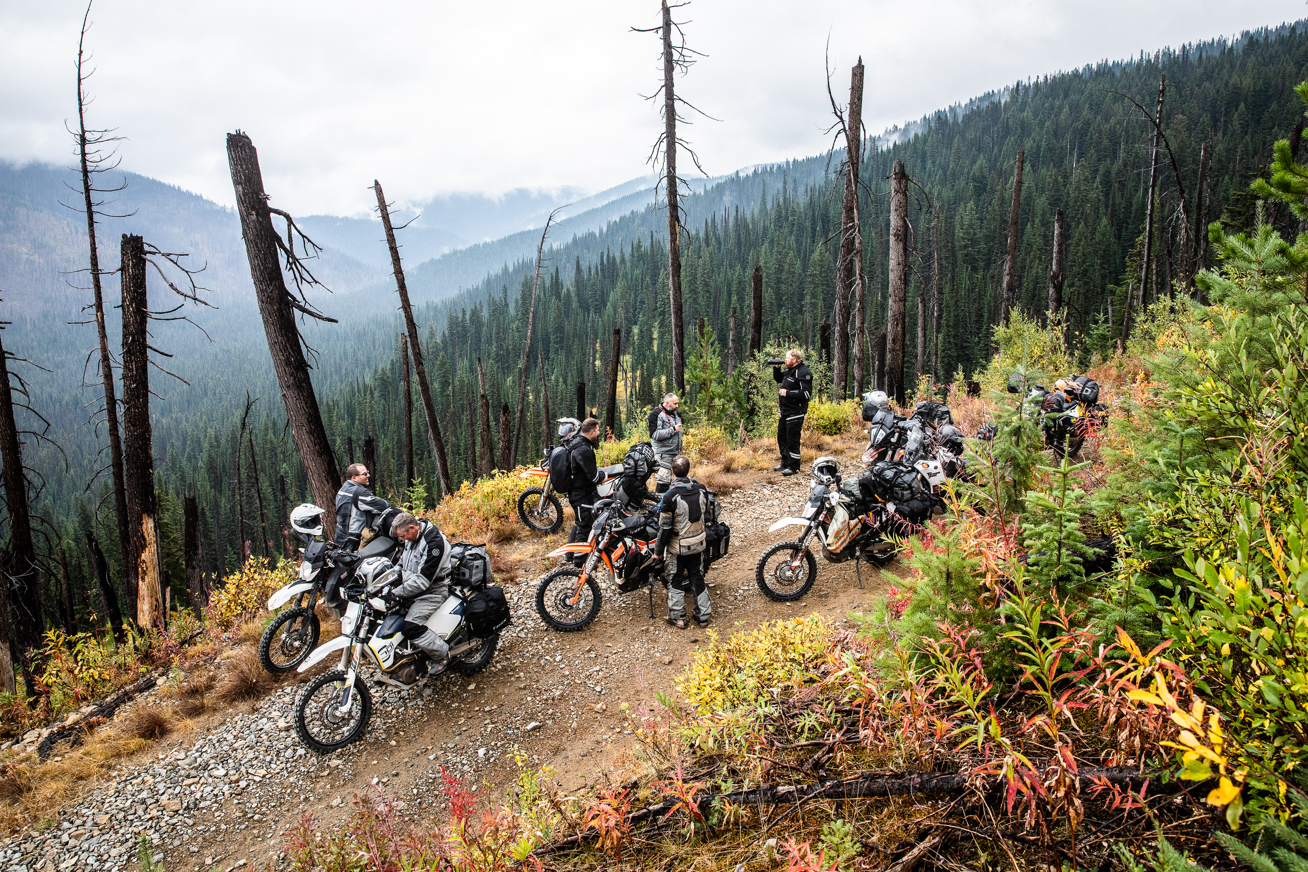
Once you’re packed and ready for another relaxed day of riding, you’ll get on the Magruder Corridor. There is some history there (check out the drop-downs for more information!), and you can tell as you ride through miles and miles of what feels like uncharted wilderness. At this point of the ride, you get hit by the feeling of vastness and true wide-open spaces.
Along the corridor, you’ll pass Burnt Knob Fire Lookout and the Nez Perce Trail (more history). Elk City is the next stop, and you’re definitely going to want to fill up your tank when you get there. We’re speaking from experience, or at least Josh’s experience of running out of gas a half mile outside of town. It’s also a great spot to get some lunch and refresh on essentials.
Once you get fueled up, you’ll head out of Elk City and drop down to the Selway river. It’s an absolutely breathtaking river that stands out against the landscape in vivid color. What’s more, the path is lined with thick ferns and tall vegetation. Up from the Selway River, you’ll be on Highway 12 on the way to Missoula, Montana. It’s not a difficult road, but it’s still important to stay alert. Charles hit a deer on our ride and was lucky to walk away virtually uninjured, partly because he was paying attention, but mostly because he had the right gear. Just as we said above, wearing the proper gear is so important because you never know what you might encounter, especially on the pavement in Idaho.
A stop in Lolo on the way to Missoula is great to let any little bikes fuel back up, plus there are some great food options. It’s a short 10 miles from Lolo to Missoula where, if you’re like us, you’ll likely want to get a motel for the night. If not, there are plenty of camping options just outside of town.
To read about the Magruder Corridor, Nez Perce Trail, and even more features along the way, see below.
Selway River
Beginning high in the Bitterroot Mountains, the Selway River travels down the range, through 47 miles of wilderness, and through a deep canyon pass. The main stem of the river is 100 miles and is home to chinook salmon, among other types of coveted fish. With its designation as a National Wild and Scenic River and a special permit system to protect it from excessive human impacts, the Selway River has exceptional water quality and provides even better scenery for mile after mile.
Selway River by Forest Service Northern Region (CC BY 2.0)
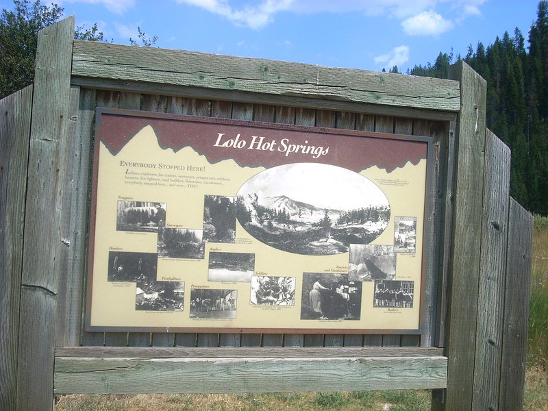
Lolo Hot Springs
Hot springs have long attracted locals and weary travelers. Hundreds of years ago, the Lolo Hot Springs were a mineral lick for wild game and ancient bathing spot for Indians, then settlers and prospectors. Now, the same swimming holes are a vacation destination for people from all walks of life. Ranging from 102-106°F year-round, the springs are a great place to relax and unwind after a long day of riding.
Log-built architecture, complimentary drinks, and a little history make the Lolo Pass Visitor Center a great stop along the way. Constructed in 2003, the building was modeled after historic Forest Service ranger stations of the past. Some of the history included throughout the visitor center is the story of Lewis and Clarke’s journey across the Bitterroot Mountains and the 1877 Flight of the Nez Perce people. Even if you don’t go inside the interpretive center, the covered picnic area and accessible restrooms are always appreciated.
The Mocus Point Trail is one that shows its cards from the beginning. A major highlight of the trail is a large suspension bridge that goes over the Lochsa River and leads into the Selway-Bitterroot Wilderness. Rather conveniently, that bridge marks the start of the trail. So, if you’re looking for a place to stretch your legs and get closer to some of the scenery, this trail is a great way to take a quick break.
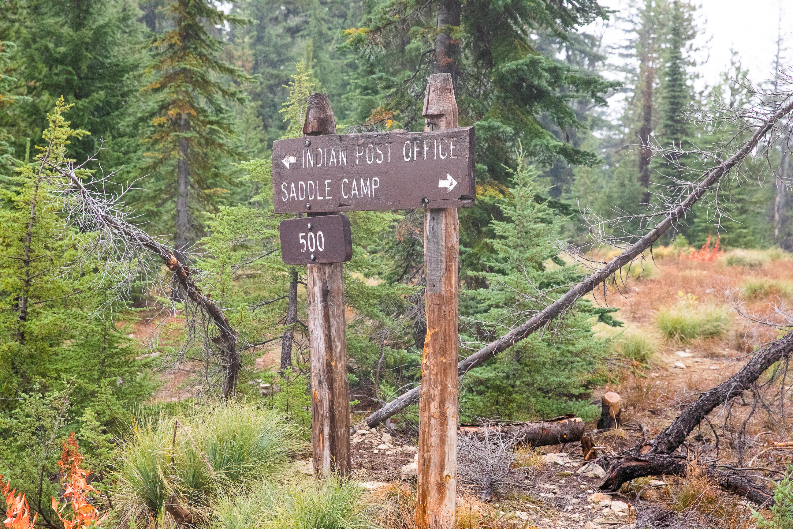
Indian Post Office
Indian Post Office isn’t an actual post office or even a building, but a rock cairn on the Lolo trail. While it’s clear that the rock tower is manmade, the purpose of it is still disputed. Some records suggest it was a spot for hunters, prospectors, and ancient Indians to leave messages for their friends, families, and fellow travelers. Other accounts suggest the marker indicates the spot where Lewis and Clarke lost their way on their return expedition of the West. Alternatively, it could just be a marker between the dividing trail and main ridge trail. Either way, it’s a unique marvel that’s fun to ride past.
Nez Perce Pass
The Nez Perce Pass is the road through nowhere. The Pass and eponymous trailhead offer access to the two major wildernesses. On one side of the Pass is the 1.2-million acre Selway-Bitterroot Wilderness, and on the other is the 2.2-million acre No Return Wilderness. Between the pass, there is wilderness nearly twice as large as Delaware and Rhode Island combined. 11% of the congressionally established wilderness area in the 48 states is included in this area. This wilderness is packed-full of history, some good, some bad. In July 1887, there was the Clearwater Battle between the Nez Perce people and the U.S. Army (discussed in future drop-downs). That battle, along with other large-scale conflicts, occurred in these wildernesses, highlighting the land struggle between American settlers and Native Americans in the early years of the United States.
Nez Perce National Historic Trail, Idaho by Bureau of Land Management (CC BY 2.0)
Burnt Knob Fire Lookout
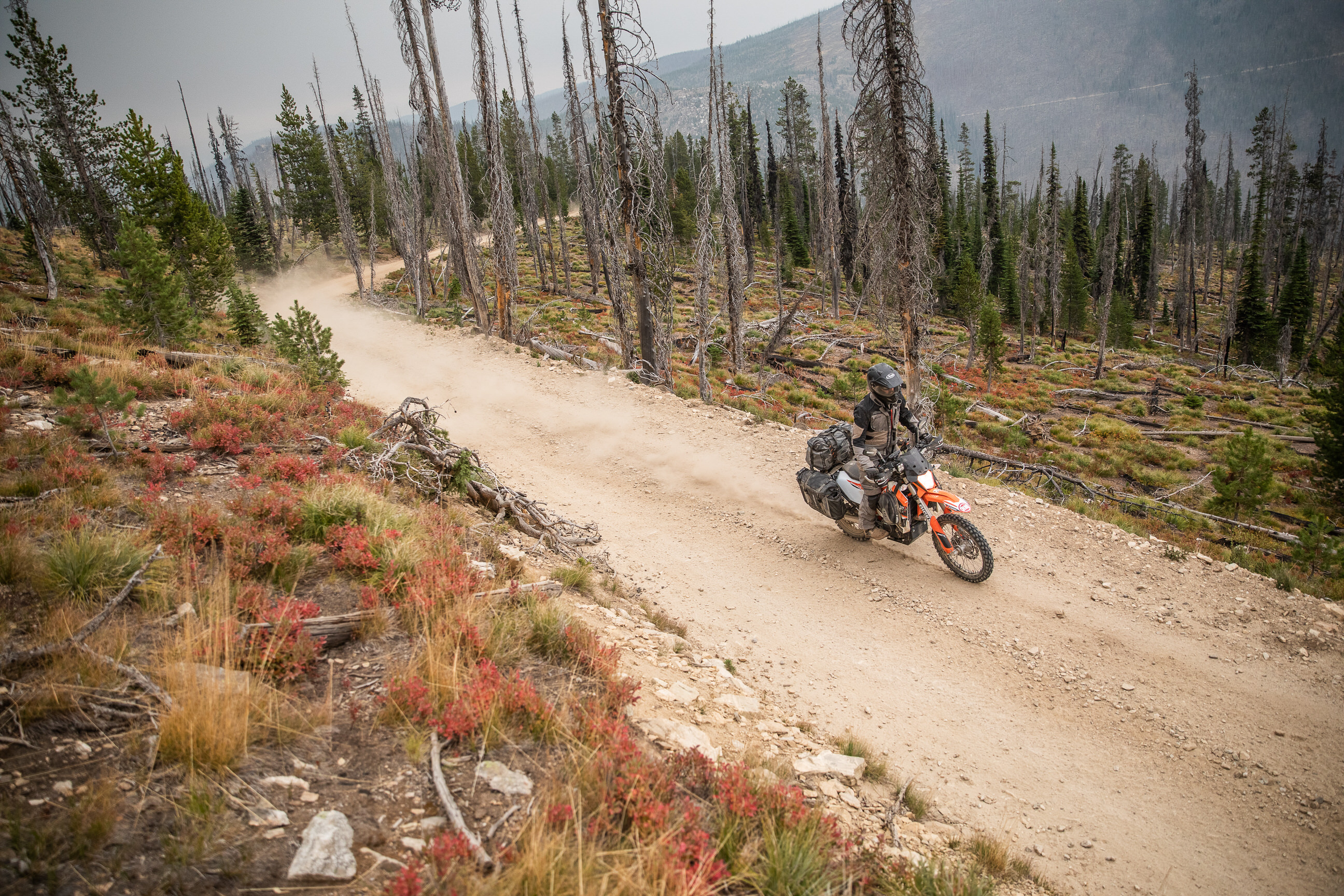
On top of a spectacular granite summit is the Burnt Knob Fire Lookout. Like most other lookouts in Idaho, this one has outlived its purpose and fallen into disrepair. Being in such poor condition, the lookout isn’t one you can tour, but it is still cool to see. The area around it has caught fire multiple times in the last 30 years, serving as a testament to these lookouts’ usefulness.
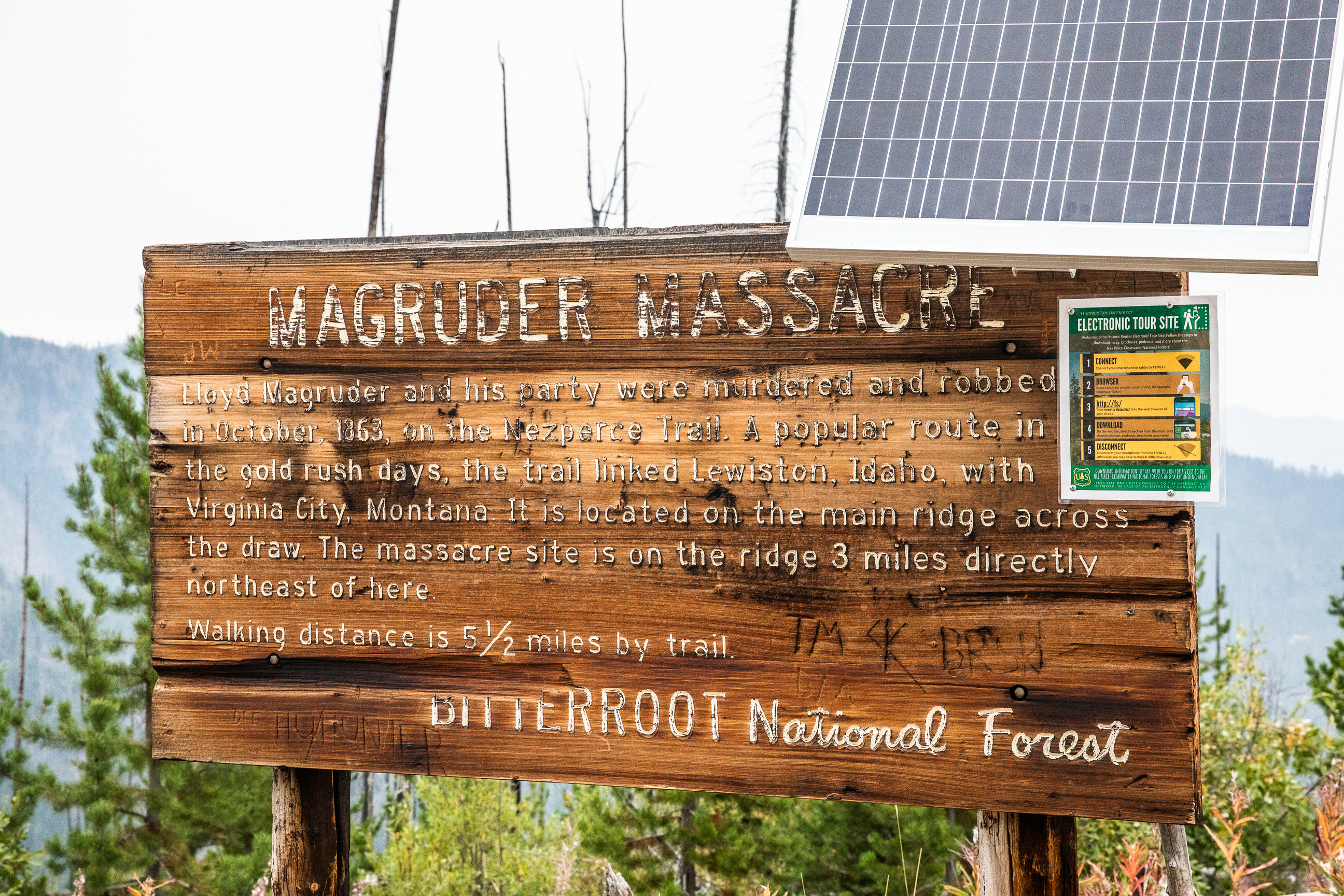
Magruder Corridor
The Magruder Corridor is 125 miles of primitive road. It’s rugged, scenic, panoramic, and beautiful. And the best part? The land has remained virtually unchanged since the Nez Perce, early settlers, and prospectors walked it – it’s a piece of living history. One of the biggest stories of the corridor – its namesake – is the Magruder Massacre. Lloyd Magruder, a pack-train operator, led four men and $30,000 in gold dust along the path. There, his entire group was murdered in their sleep by four men. After killing the group with axes and dumping their bodies over a cliff, the four-man crew escaped and fled the state. They were later tracked down in San Francisco by a friend of the victims and hauled back to Lewiston, where they were then convicted of the murders and hanged.
GPS File Name: Missoula to Pierce
GPS File Name: Pierce to Yellow Pine
Our fifth day started with rain, lots and lots of rain. It’s never fun to get rained on during a ride, but the water cleared up the skies and showed us the beautiful fall colors that were dimmed by the smoke.
Leaving Missoula, head down to the Lolo Motorway pull off. It doesn’t take long to get back into that vast wilderness. You’ll ride like this, through the wilderness and over mountain ridges until you get to Pierce. It was everyone’s favorite part of the ride. The dirt was wet and the dust was gone, showcasing the truly unmatched scenery. We took a longer break in Pierce on account of the relentless rain, so it took us a while to get back on the road after resting, refueling, and restocking supplies. It really is “back on the road” after that, as the last 80 or so miles of the day are on the highway. Once you get to Grangeville, we recommend grabbing dinner and finding a place to either stay or make camp. We would’ve preferred the former after the long, wet ride, but still enjoyed the latter after stopping off at Fish Creek Meadow Campground for the night.
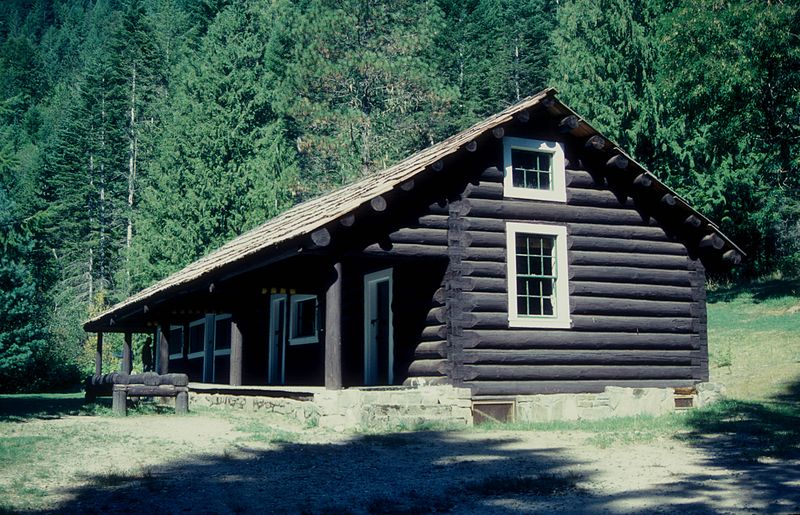
Lochsa Historical Ranger Station
From 1925 to the mid-1950s, the Lochsa Ranger Station was a backcountry station manned by the local Forest Service division. It was the hub of all of the action in the area – fire lookouts, smoke chaser cabins, even a functional corral. Back in its heyday, the corral would hold horses and mules while they waited to carry supplies through the wilderness. Since becoming a historical site in 1976, self-guided tours are available of the well-preserved station and all surrounding buildings.
Lochsa Historical Ranger Station by Jerrye and Roy Klotz MD (CC BY-SA 3.0)
Hemlock Butte Lookout Tower
Hemlock Butte Lookout Tower is one of the few fire towers still actively manned. Managed by the Lochsa/Powell Ranger District, the cabin is 14’x14’ with a catwalk on a 54’ tower. This version is at least the fourth iteration of the lookout. In 1919, the lookout was just a roofed platform. In 1923, it became a cabin, and in 1934, a 50’ tower was added. The latest improvement was in 1954 when an extra 4’ was added to the tower and some structural improvements were made. To this day, the tower is used to scout out wildfires, so if you do decide to stop, be mindful of any Forest Service vehicles or employees accessing the tower.
Nez Perce Heart of the Monster
Each culture has a creation story, and the Nez Perce Indians are no different. Their story starts with the Iceye-ye, the coyote. He discovered that a monster was eating all of the animals in the land. Cunning as he was, the coyote tricked the monster into swallowing him. Unbeknownst to the monster, the coyote had a set of stone knives hidden in his fur. Once inside the monster, the coyote cut apart his belly and freed the other animals that had been trapped inside. The coyote then cut up the monster, throwing its pieces all over the land. These pieces became the Indian people. A fox, who had seen this happen, asked the Coyote why only the land away from the monster had people, not the land where the monster was killed. The coyote then washed his hands, and the drops of blood that fell from them became the Nez Perce people. The Heart of the Monster is a dedication to this event, and the entire 53-acre site has great meaning to the Nez Perce nation.
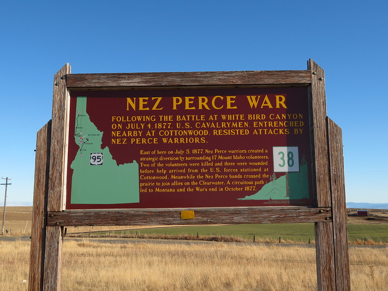
Clearwater Battlefield
The Clearwater Battlefield was the site of a great battle between the Nez Perce and United States army. Before the Battle at Clearwater was the Battle at White Bird. American General Oliver O. Howard saw a camp of non-treaty Nez Perce people below a ridge he was camping on, so he ordered canon fire on the camp. The Nez Perce retaliated, and were then pursued by the army across their reservation and around several rivers. That’s when the Clearwater Battle commenced. The army ambushed the Indians, and there were significant causalities on both sides. Following the battle, the Nez Perce retreated, crossing into the Bitterroot Mountains via Lolo Pass. A historical marker on the site expressed much of this as the actual battlefield is on private property, though you can see much of it from the pullout with the marker.
Nez Perce War, Idaho Historical Marker No. 38, Cottonwood, Idaho by Ken Lund (CC BY-SA 2.0)
Bicentennial Historical Museum
If you want a hands-on look into the Nez Perce way of life, the Bicentennial Historical Museum is a great place to start. Several Nez Perce artifacts like corn husk bags, beaded bags, pipes, beads, moccasins, gloves, pack saddles, and ore are all included in the museum. Along with the Native American history exhibits are ones that feature early mining history and Idaho history more generally.
The morning in the Fish Creek Meadow Campground was slow and beautiful. As we packed up camp, we reminisced on how the rain cleared up all the dust and brought out the fall colors. In cases like that, sometimes the rain is appreciated, even if it does mean getting a little wet. After a little bike maintenance, we were ready to roll out. It’s worth it to give your bikes a once-over each morning to make sure everything is looking good – our bikes certainly needed it this morning.
Heading out of camp, we planned to make it to Yellow Pine by the end of the night to make up some time. If that really happened is a different story, but it was a beautiful ride all the same. A look at the map put us riding a paved road out of camp, then onto dirt roads towards Yellow Pine.
The day starts by riding south towards Florence. An old cemetery and ghost town are just off the side of the road in Florence and certainly make for a cool stop. Continuing down the road, you’ll eventually reach a ridge where you can see all of the logging switchbacks that you’ll be riding down. They look pretty gnarly, but that’s what makes them a whole lot of fun. We learned the hard way, though, that you really need to pay attention – Justin tried to mess around with his helmet-mounted GoPro and ended up washing out and tweaking his leg. He was fine to ride after a short break, but he probably would’ve preferred to not have crashed at all. If you keep your focus on the terrain, you’ll hopefully avoid making the same mistake.
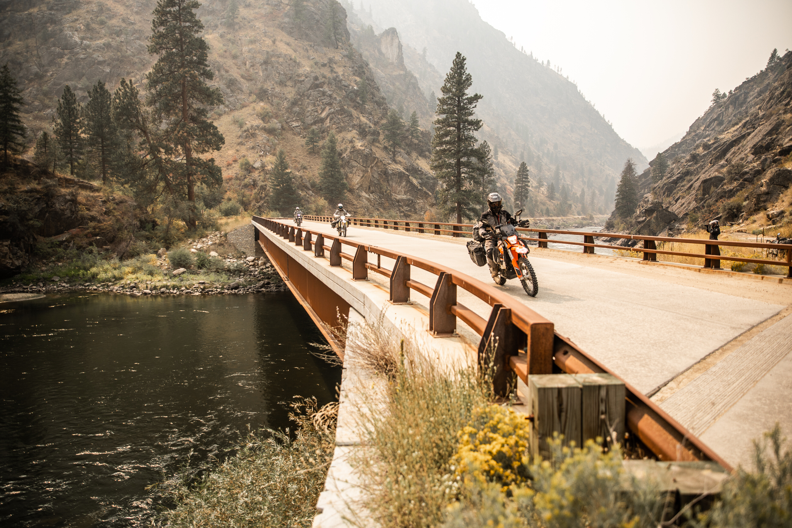
Through the logging roads, one of the highlights for us was fresh fruit. Blackberries and plums were vine-ripened and in abundance, and we’d recommend taking full advantage of the sweet snack as you ride past. The road dips down to the Salmon River around this part of the route, and it’s a scenic place to stop and take a break. From the base of the canyon, you can see the next mountain you’ll be riding up. On the way, you’ll ride over the Manning Bridge, a suspension-cable marvel in what feels like the middle of nowhere.
Several times during this day of riding, we were struck by how smooth, scenic, and flowy the roads were. All of the roads in Utah are beat-up and graveled by comparison. If your local trails are similar to Utah’s, you’ll be falling in love with Idaho just as much as we were.
Pushing down the road, you’ll eventually arrive at an old bus on the side of the road. Bring a sticker with you so you can leave your mark – we certainly did. Past the bus is the rustic Burgdorf Hot Springs, though they were unfortunately closed due to the extremely active fire season. We rode straight on to Secesh Stage Stop to get gas and grab a later lunch. It’s one of those local places packed-full of character, so we didn’t mind taking a longer break to unwind from all the crashes and mishaps we’d already had. We decided here that we’d had our day’s fill of riding, so we pulled into Shiefer Campground earlier in the day and only a few miles past the Stage Stop. With a bag full of blackberries and minds full of concern about bears, we hunkered down the for the night to prep for two more days of fast riding.
Check out below to learn more about the route and the cool things you can see along the way.
Florence Cemetery and Ghost Town
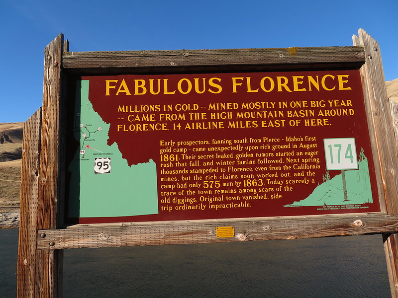
In its time, Florence was a bustling city of over 9,000. In 1861, the town was founded in anticipation of the Gold Rush. After just a year, the town had its near-10,000 residents, a sawmill, 10 butcher shops, seven bakeries, eight lawyers, six gambling saloons, a dance house, a Masonic Hall, and a jail. Once a placer mining machine was established in the area, however, the resources were quickly depleted. As the resources disappeared, so did the people. Only 575 residents were in the city by the first census of the area, and it was completely abandoned sometime after 1951. Several mines in the area, along with a cemetery, are in ruins like the rest of the town.
Fabulous Florence, Idaho Historical Marker 174, Between Riggins and White Bird, Idaho by Ken Lund (CC BY-SA 2.0)
Manning Bridge
Over the narrow, rocky Salmon River Canyon is the Manning Bridge. Only seven types of these bridges exist in the entire world, and you’ll ride right over one of them if you take our route. What makes this bridge so unique is that it connects to the side of the canyon. An 80’ tower holds six wound steel cables, 3” thick each. Those cables swoop down on the other side to connect to the canyon. It took two years and $9.6 million to build the single tower asymmetric roadway suspension bridge, and it’s going to be an Idaho staple for many years to come.
20150812-FS-UNK-0017 by U.S. Department of Agriculture (CC BY 2.0)
Schesch Stage Stop
It’s great food and better company – the Schesch Stage Stop is a restaurant-bar combination that is some of the best food in the area. Burgers, hot dogs, and rotating specials always hit the mark, though you don’t have much of a choice as the rustic roadhouse is pretty much in the middle of nowhere. Along with the food and drink, there are cabins and tent sites available for rent, and fuel pumps for all types of travelers.
Burgdorf Resort
The Burdorf Resort offers some of the hottest and most scenic hot springs in the area. Reaching up to 113°, the pots offer some well-earned relaxation for cold and saddle-sore riders. Nestled in the forest and part of the resort, the springs provide privacy and solitude. Many of the cabins on the property have been standing since 1923, and the area has been a National Historic Site since 1961. If you’re interested in visiting the resort, be sure to visit their website to confirm availability.
Warren Mining Town
After a prospector named Warren found a gold vein in the area, the Warren Mining Town was formed. It was a town that hosted weary gold-hunters from Pierce and Florence, though Warren never achieved the same size and popularity that those towns did. A gold dredge was built in the area, but it was shut down in 1942 due to WWII. Since then, citizens left the town in droves, though 12 full-time residents are still in the city to this day.
Yellow Pine Tavern
The Yellow Pine Tavern was first built in the 1940s and has been run by the same family ever since. It’s a long-standing, long-term relic of the area, and is another stop full of great and helpful locals. Breakfast, burgers, pizza, snacks, and drinks are always available, but sometimes local events like music festivals are hosted by the Tavern. Either way, it’s a must-stop on the route through Idaho.
GPS File Name: Yellow Pine to Lowman
GPS File Name: Lowman to Featherville
GPS File Name: Featherville to Ketchum
GPS File Name: Ketchum to Lost River
GPS File Name: Bellvue to Arco Slab
If you’re like us, the morning of Day 7 is when you wake up feeling pretty beat. It’s the type of tired that only comes from being out there and riding for a week, though, so it’s a good feeling in that regard. Either way, the thought of making it home to a bed and shower is an exciting one at this point.
After giving the bikes another routine check, ride out of camp towards Yellow Pine. There, you can grab some gas and chat with some of the locals. Everyone will tell you to either stick around or come back to the area as there is so much more to it than just the road through town. The views are certainly incredible, but to get back to Arco by the end of Day 8, you need to trek on. If you’ve got a longer timeline, than take your time and enjoy the scenery.
Riding past Yellow Pine, you’ll make it to Loman. This is a great place to stop and grab some snacks. You won’t be making another stop until dinner, so stock up on everything you need to get through the rest of the 250-mile day. Back on the road, we passed another active fire but managed to stay on-route. The rest of the day is up one mountain and down the other until arriving at Featherville. There’s a great café there to get some tasty pizza before you head to camp. We were planning on stopping at Baumgartner Campground, but the whole side of the road was closed due to a fire. We settled on a campground by Willow Creek and got some well-earned rest to prepare for the last leg of the ride.
Day 8 is a day of straight riding. Arco is waiting, and so is home. Head straight from camp to Ketchum for fuel, then get back on the road. As we rode, we thought about our favorite stops on the trip and our favorite things about adventure riding more generally. It was a great end to an even greater ride. The day passed quickly, and we were back in Arco before sundown. If you have the time and don’t want to stick to the pavement, we have a couple different alternate routes for the final leg. There’s also plenty of points of interest to check out on your way back to Arco.
Featherville Resort
Yet another little stop along the river, the Featherville Resort is a saloon, restaurant, gift shop, and motel. An old mining town was updated and remodeled to become Featherville in its entirety. At this point in the ride, it’s a great place to stop and get some last-minute souvenirs for those at home.
Smoky Bar Store
Basic amenities throughout the ride are always appreciated, especially when they come by way of a cultural institution. The Smoky Bar Store is a family-run business in the middle of the forest. Open from May-December, you’ll find the basic food and drink, along with some merch representing the Smoky Bar brand. The store also offers workshops and live music, so who knows what will be happening when your riding group rolls up!
Sawtooth Botanical Garden
The type of flora and fauna in high altitudes is unique, and the Sawtooth Botanical Garden seeks to showcase that with their beautiful cultivated gardens. The public garden puts plants that are hard to access right on display, making it an informative and exciting stop. The area is organized with different gardens and themes, all of which are explained in detail in the garden’s helpful visitor center.
Boxcar Bend Nature Preserve
In 1952, the Union Pacific Railroad placed several boxcars in the Big Wood River area in an effort to store and preserve them. The boxcars lay dormant, however, and began to rust and fall apart. So, the locals took it upon themselves to clean it up. The river has since been restored and is now a scenic nature area for easy-going outdoor recreation.
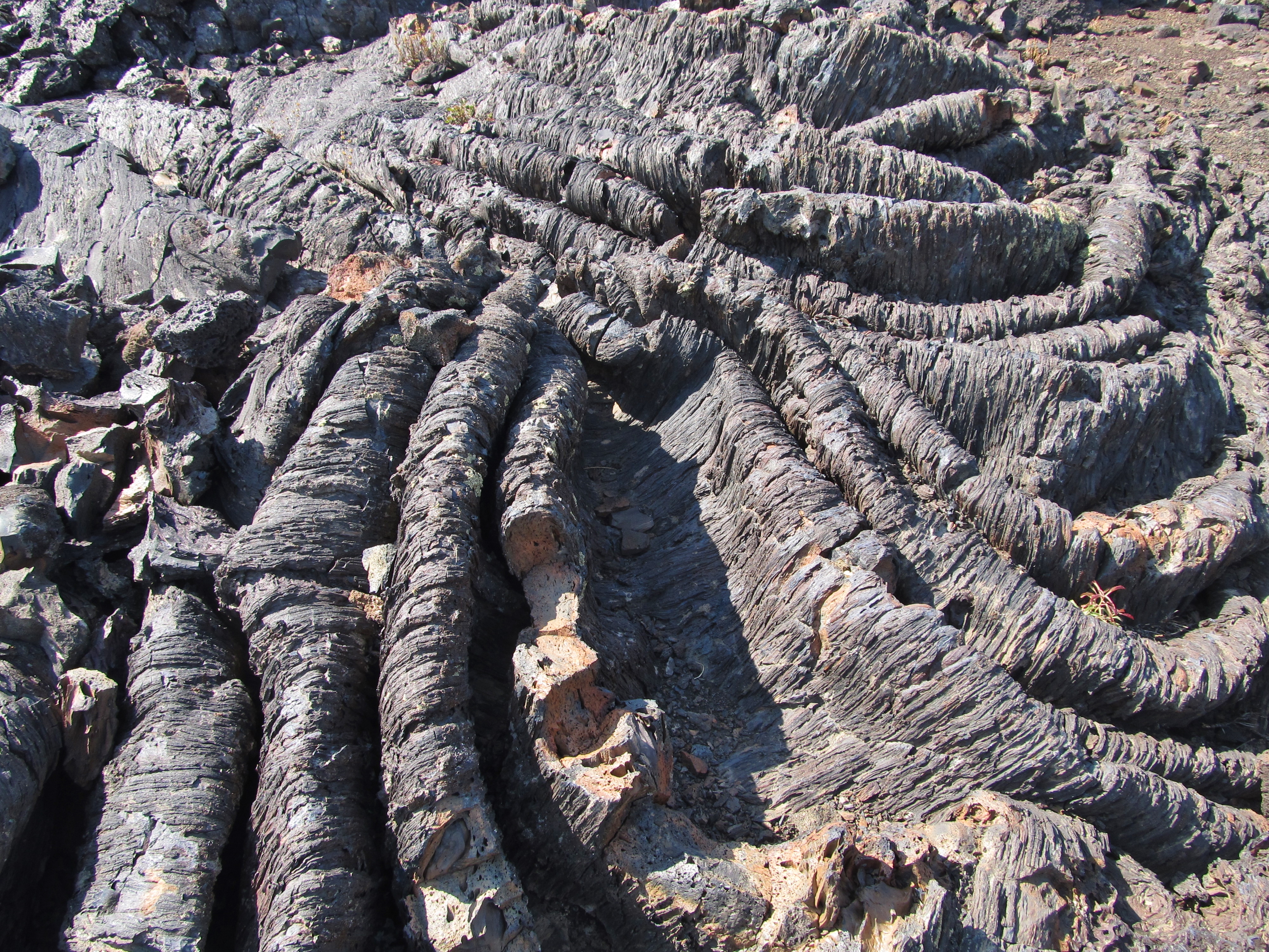
Craters of the Moon National Monument and Reserve
Craters of the Moon National Monument and Reserve is an incredibly unique and surreal landscape formed by lava. Centuries ago, lava flows oozed from fissures in the earth, sometimes even spewing out of vents. The slow flow of lava, as compared to a standard eruption, created the landmarks like cinder cones, lava tubes, tree molds, lava rivers, spatter cones, and lava beds. The park is along the Great Rift of Idaho, featuring some of the deepest rift cracks known on Earth at 800 feet. The area includes 410,000 acres of this landscape, all of which is begging to be explored. Out of all the stops we could’ve made on this trip, this is the one we regret missing the most.
Craters of the Moon National Monument and Preserve by Jasperdo (CC BY-NC-ND 2.0)
Conclusion
Up and over secluded summits, through deep green pines, beside teeming rivers, and alongside friends, the Rocky Mountain Idaho Adventure Motorcycle Tour is an 8-day route packed-full of stunning scenery and incredible history.
We’ve loved every second of this adventure ride and are excited to share it with you. If you plan on going on your own Idaho Adventure Tour, share your experience with us in the comments below. And don’t forget to subscribe to our YouTube channel and follow our blog to stay updated on future rides.
Disclaimer
Route information and GPS files are provided to you "as is". Rocky Mountain ATV/MC and RM Rides makes no warranty that the information contained therein is accurate or the information is fit for any particular use. Furthermore, Rocky Mountain ATV/MC and RM Rides disclaim all liability from any damages which may arise (directly or indirectly) from your access and use of the information or files. By accessing the route information or GPS files, you acknowledge that you take full responsibility for your actions (or lack of action) in relation to them. The information and details supplied are not a substitute for proper planning. Check with the official representatives of the agency or organization that governs or operates a particular riding location, gas station, campsite, or point of interest to determine current accessibility, special rules, hours of operation, or exact boundaries that are appropriate for powersport vehicle use.
Disclaimer
Riding any type of powersports vehicle can be a dangerous activity and is done at your own risk. The riding tips, techniques, videos, and photos that Rocky Mountain ATV/MC posts on this site feature both professional and experienced riders and may cause serious injury or even death. Riding at high speeds or participating in stunt riding is inherently dangerous. Rocky Mountain ATV/MC disclaims all liability from any and all losses, damages, injuries, paralysis, or death that may occur by trying any of the riding tips, techniques, stunts, photos, videos, or content found on this website, either posted by Rocky Mountain ATV/MC or visitors of the site. Furthermore, we recommend you always wear a helmet and the appropriate safety gear when riding and that you assess your own capabilities and skill level before attempting any rid, terrain, stunt, or technique. Some of the content, videos, and photos presented on this site have been sent to us by our customers. All information presented in the content, videos, and photos, including tricks, views, opinions, or positions of Rocky Mountain ATV/MC or their affiliates.